Afternoon in Death Valley

America’s most inhospitable environment is a surreal geologic wonderland comprised of expansive salt flats, color-stained rocks and weathered badlands. In Death Valley, you will meet singing sand, desert fish and a golf course from hell.

fullsizeoutput_4fa8.jpeg
Half a league onward...Into the valley of Death
Rode the six hundred.
— The Charge of the Light Brigade by Alfred, Lord Tennyson

Why would anyone ever venture into somewhere with the moniker Death Valley? The landscape is desolate, animals (seemingly) scarce, and long stretches of empty roads dot the seemingly infinite landscape. The most daunting aspect of the area is the oppressive summer heat. The world record for atmospheric temperature was recorded here in 1913 at a scorching 134 degrees Fahrenheit (F). If you think that has to be an aberration, think again. The hottest month on record here was July 2018, with a smoldering average of 108 degrees F. 21 days that month reached, or exceeded, 120 degrees. Suffice to say that you do not want to enter Death Valley in the summer months. But that does not mean you should never venture there at all.

Many of Death Valley’s most popular sites for those in a rush are located along State Route 190, the Park’s main, and often empty, road.

Many of Death Valley’s most popular sites for those in a rush are located along State Route 190, the Park’s main, and often empty, road.

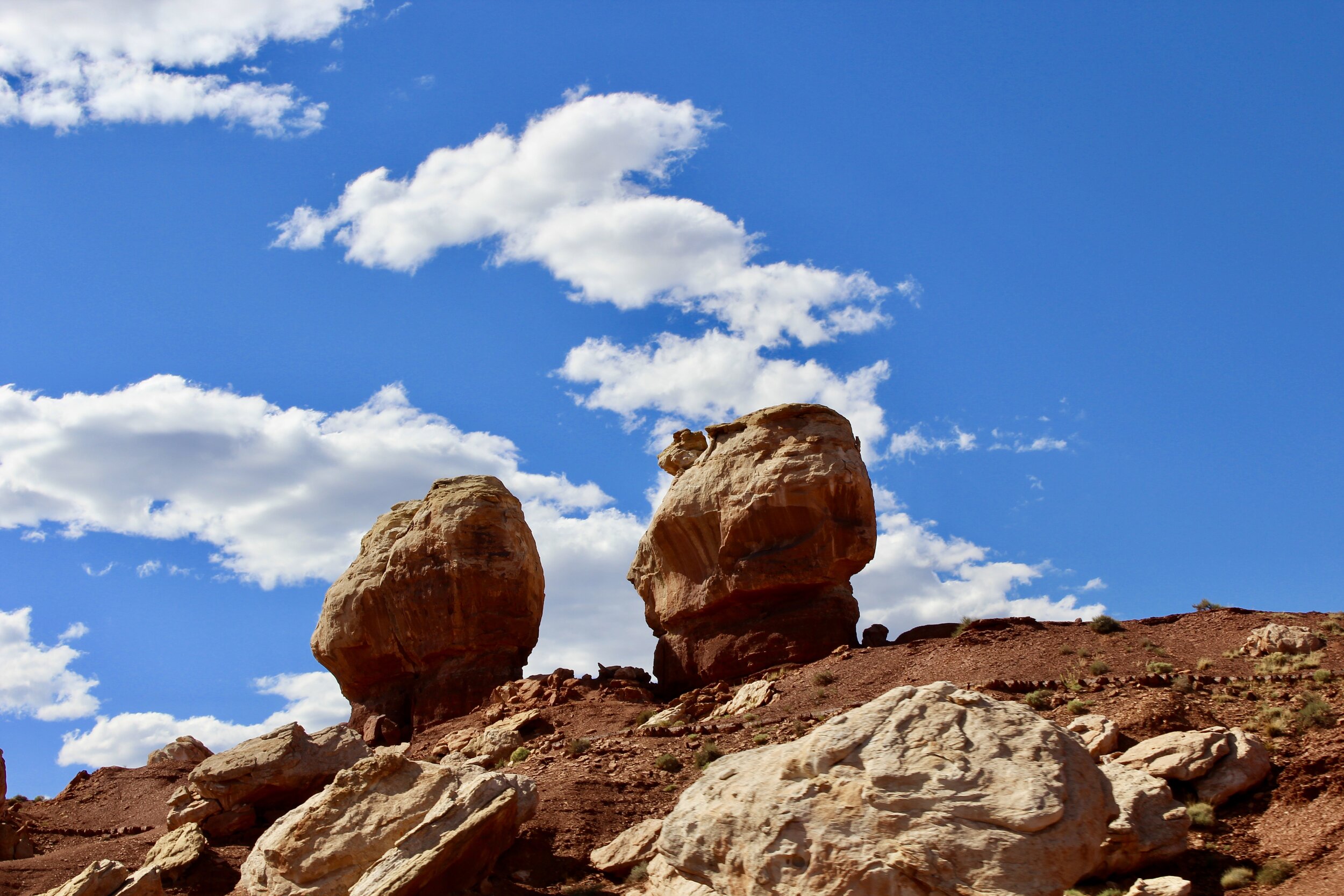
Death Valley is a land of extremes, spanning a range of habitats and ecosystems that support some of the hardiest life on earth. In only this park, you can see soaring, snow-capped peaks rise above barren, alien salt flats and windswept sand dunes. Rugged badlands and chemically-stained rocks give this brutal landscape an otherworldly beauty. Even incredible fish live here! Death Valley may be brutal, but it is well worth a visit, as its nearly 1 million visitors a year can attest. Just bring a lot of water and make sure the fuel tank is topped off.

6:30 AM

I head out to Death Valley from Los Angeles on the first day of February, 2020. Death Valley National Park, which received that distinction in 1994, is about 4 hours northeast of Los Angeles, straddling the California-Nevada border deep in the Mojave Desert, the driest desert in America. After slowly slithering through Los Angeles’s never ending “rush hour”, the road opens up around Palmdale. As the cars around me begin to fall behind and out of view, the landscape empties as mountains rise on the sides of the increasingly bumpy and dusty road. After traversing a mountain pass, I descend, and descend, into Panamint Valley, southwest of the Park. I am one of the only cars on this lonely stretch of road as I fly past the lonely sign denoting that you are entering a National Park. You would have no way of knowing otherwise.

11:00 AM

Even though it is not crucial, I top off the tank at a gas station in the tiny town of Panamint Springs, nuzzled just inside of the Park’s border. Death Valley, the largest national park outside of Alaska at a sprawling 3.4 million acres, is no place to be with a dwindling fuel tank. I pick up a map and head into the heart of the park towards the two larger visitor centers at Stovepipe Wells Village and Furnace Creek (aptly named because this is where the ungodly 134 degrees was recorded). Along the way the highway descends again. Through the windshield, however, you can see the highway climb vertically into the Panamint Mountains as I drive towards Stovepipe Wells Village.

11:45 AM

After paying the visitor’s fee and refilling the water bottles, I leave Stovepipe Wells for the Mesquite Dunes. Nothing signifies a desert like towering sand dunes. Some of the dunes here rise a hundred feet high, making them some of the tallest dunes in the Park and by far the most accessible. If you make it to the Eureka Dunes, the park’s largest clump of dunes, keep your ears open for eerie bass notes in the air. This is due to a haunting phenomenon known as singing sand. Although we picture seas of sand when we imagine deserts, under one percent of Death Valley is actually covered with sand dunes.

The constantly shifting sand dunes are covered in ripples etched in the silky sand by wind (especially when I was there, when wind speeds were over 20 miles per hour in some parts of the park). Many people visit around sunrise and sunset to take pictures of the dunes as they’re bathed by the sun’s most vulnerable rays, and some even partake in hikes after the dark when only the moon can guide you over the dunes. Signs in the parking lot warn late visitors to be careful of sidewinder rattlesnakes who emerge from the dunes after dark. These venomous snakes, named for their efficient style of desert locomotion, often sit motionless, with just their eyes and devil-like horns poking above the sand.

The sidewinder is part of one of the many ecosystems that exist in Death Valley, the hottest and driest place on the continent. Elsewhere in the park, isolated wetlands and springs offer an often fleeting view of what this area used to look like thousands of years ago. 15,000 years ago, this hellish “wasteland” would have been submerged by lakes. Hundreds of millions of years ago, it would have been buried beneath glaciers.

The few areas that have managed to stay wet as Death Valley dried out support some of the most hardy species of fish on the planet, collectively known as pupfish. Large swaths of dry desert lie between these tiny bodies of water, which has led to the development of nine different species of pupfish in Death Valley National Park alone. As Darwin discovered thanks to the existence of unique tortoises and finch species on the different Galapagos Islands, isolation kick starts evolution. Isolation here has created unique species like the endangered Devil’s Hole pupfish, which lives in an underwater cave where water temperatures rise above 90 degrees. Despite efforts to preserve the Devil’s Hole pupfish, these tiny, shimmering blue fish (only around 35 mm long as adults) are picky breeders, only reproducing on a shallow shelf in Devil’s Hole before the cave drops another 500 feet into the earth. This phenomenon effectively takes captive breeding out of the equation.

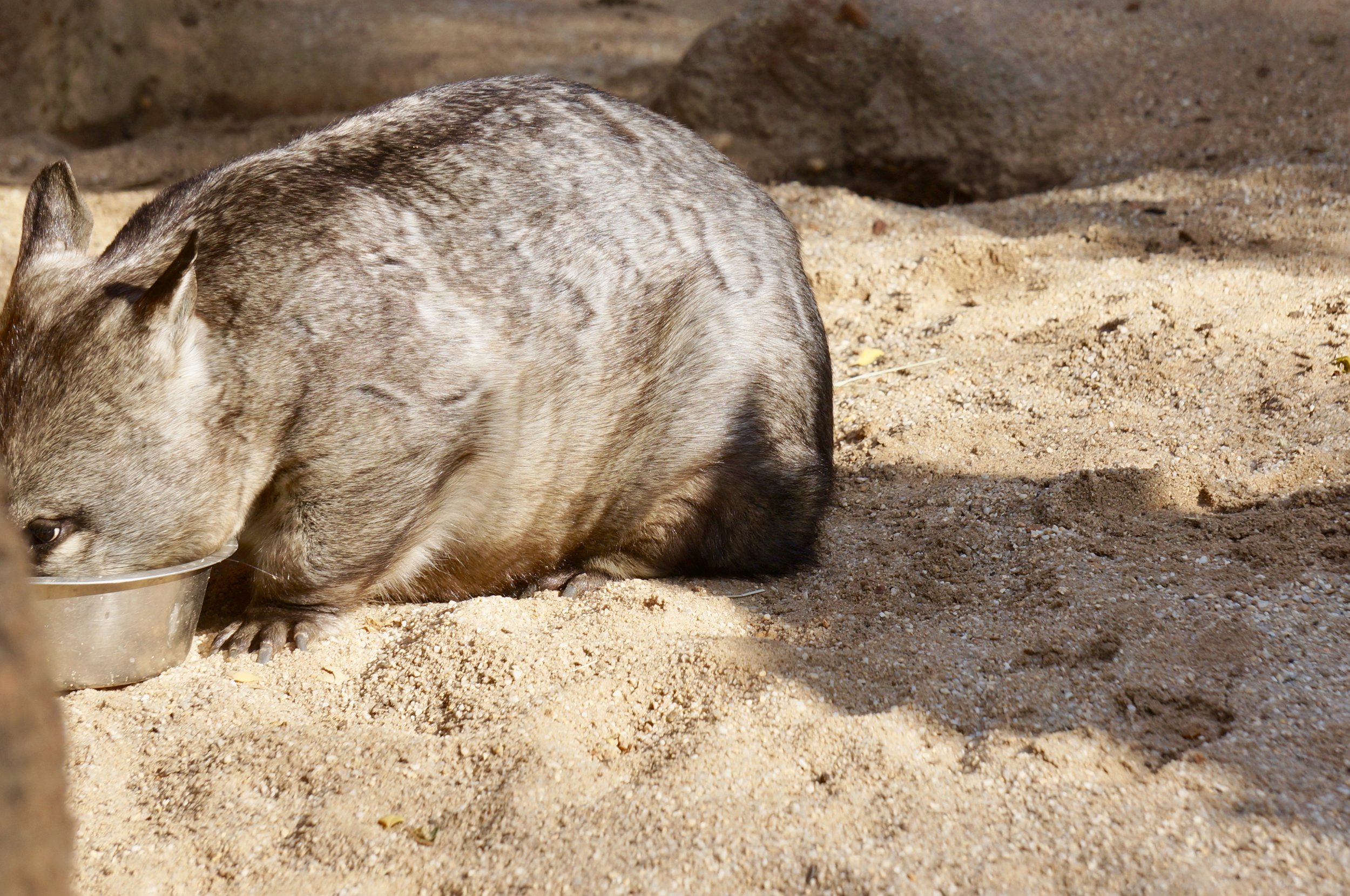
Despite the macabre name, Death Valley is also home to a whole host of other sturdy organisms that not only survive but thrive here. The desert bighorn sheep that scale the Park’s mountain slopes can survive days without water. Taking it one step further, kangaroo rats can survive their whole lives without a drop of water, obtaining the minimal amount of moisture they need from their vegetarian diet. The desert tortoise spends up to 3/4 of its year in its burrow to avoid the Park’s searing heat. Similarly, many species, like bobcats, are nocturnal, avoiding the heat at all costs.

Reptiles, like this desert banded gecko, are some of the most successful creatures inhabiting Death Valley. Like the desert tortoise and banded gecko, many burrow into the ground to avoid the most extreme temperatures. Picture taken at the Phoenix Z…

Reptiles, like this desert banded gecko, are some of the most successful creatures inhabiting Death Valley. Like the desert tortoise and banded gecko, many burrow into the ground to avoid the most extreme temperatures. Picture taken at the Phoenix Zoo.

12:30 PM

The beginning of a trail that enters into the badlands at Zabriskie Point.

The beginning of a trail that enters into the badlands at Zabriskie Point.

After stopping at Furnace Creek to grab a sandwich and some post cards at the visitor’s center, I make my way to Zabriskie Point, one of the most picturesque sites in the entire park. These badlands are composed of sediments from a dried-up ancient lake where camels and mastodons once trudged along the shore. These canyons are the masterpiece of millions of years of erosion, which makes the rocks appear to be covered by a wrinkled blanket. The weathered rocks that form these badlands range in colors from dull gold to mustard yellow to a rich, coffee brown, which indicates that lava once seeped through here from nearby volcanoes some 3-5 million years ago.

A view of Manly Beacon, the point jutting above the rest of the weathered badlands, from the top of Zabriskie Point.

A view of Manly Beacon, the point jutting above the rest of the weathered badlands, from the top of Zabriskie Point.

This location, named after a manager of an early 20th century borax mining company, is best viewed at sunset or sunrise, when the richly-textured rocks glow orange and red. The iconic area has also been pictured on the cover to U2’s critically-acclaimed Joshua Tree album and was the setting for a scene in Stanley Kubrick’s Spartacus as a stand-in for ancient Egypt. As I get back into my car and pull out of the parking lot, Bruce Springsteen’s Badlands serendipitously blares through the radio as I snake back towards the main road, moving past millions of years of time trapped in weathered rocks.

A panoramic view of the badlands taken on my phone at Zabriskie Point.

1:15 PM

After arriving back on State Route 190, my car begins a continual descent towards the bottom of North America. But first I need to visit Artist’s Drive, a scenic drive cutting through a rainbow of rock. Slowly winding through nine miles of eroded cliffs and canyons, the splash of color jumps right out at you and beckons you to pull the car over for a closer look. While Zabriskie’s point exploded with earth tones, Artist’s Palette, the drive’s most famous spot, is a collection of rocks that form a kaleidoscope of bright colors. The colors, which range from mint green to a bright, chalky pink, are the result of the oxidation of chemicals (losing an electron according to high school chemistry) in the ground here. The oxidation of iron, for example, creates red and pink-hued rocks while oxidizing manganese produces the soft purples. This entire formation of colorful rocks was created by a particularly violent volcanic eruption millions of years ago that left enormous amounts of dried lava behind. Millions of years of chemical weathering and the occasional downpour of rain made these colors pop. If you get an eerie sense that you’ve seen Artist’s Drive (and its vivid landscape) before, it may be because the area was featured in the first Star Wars film, 1977’s iconic A New Hope.

Above: Artist’s Palette (first two images) glimmers in the afternoon light, but the rest of Artist’s Drive is not to be overlooked.

2:15 PM

After winding through the rest of Artist’s Drive on the heels of a strategic bathroom break, I again hit the open road destined for Badwater Basin, the lowest point on the continent. The sun was beginning to sink in the sky as I pushed down the lonely road, the wind sweeping dust across the paved highway. But before I descended to rock bottom, an intriguing sign caught my attention. It denoted that the next turn would lead to Devil’s Golf Course. It’s not surprising that Death Valley, as its name suggests, has several grimly-named locations within its boundaries. Hell’s Gate. Desolation Canyon. Dante’s View. But none of these piqued my interest like the Devil’s Golf Course. And it delivered.

Only the Devil would unwind by playing golf here.

Only the Devil would unwind by playing golf here.

Jagged rocks, smothered with crystallized salt, stretch as far as the eye can see. It is said that these rocks are so sharp (and extremely hot most of the year) that only the devil would tee off here. But it is no stretch to imagine that even his cloven hooves being cut up on these razor-like rocks. When the temperature rises, this golf course is filled with subtle sounds of metallic cracking as the salt crystals expand and contract.

3:00 PM

A sign at Badwater Basin denoting the location’s extreme altitude.

Just down the road from the most forbidding golf course in the world is Badwater Basin, one of the most popular sites in the park. Less than 85 miles from the highest point in the continental United States, Badwater Basin is submerged some 282 feet below sea level! The land here is covered in a think blanket of salt, almost 60 inches thick at some points.

Where is all of this salt from? The Badwater Basin salt flat is comprised of salt from an area as large as New Hampshire that trickles down from mountains, carrying minerals with it and eventually landing at the continent’s lowest point. As a result, Badwater Basin is often temporarily covered in water. Near the road is (usually) a small pool of incredibly salty water that gave this area its name when a prospector’s mule refused to drink it. But on the adjacent salt flats, the water never lasts for long. Once it evaporates (the area has the highest rate of evaporation in the country), only the salt is left. Strikingly, the salt flat is covered by hexagonal, honeycomb-shapes, the result of constantly expanding and retracting salt crystals. These shapes only add to the area’s alien feel.

The walkable path extends into the snow-like salt flat for what seems like miles. The salt stretches even further to where it meets the base of the surrounding mountains. As is usually the case, walking too far off the path could result in breaking through the salt (which is only a couple inches thick at some points) into mud below it. Not an ideal way to end a day in Death Valley.

This desolate area was bequeathed with its unwelcoming name by a group of pioneers unfortunate enough to be stranded in this hostile environment in 1849. Although only one of them perished here, another triumphantly exclaimed as they escaped across the surrounding mountains, “Goodbye, Death Valley!” The name stuck. Walking back toward my car after the sun dropped below Badwater Basin’s mountainous backdrop, leaving the salt flat an eerie dark blue, the quietness of this landscape made any comparison to a valley of the dead conceivable.

The Badwater Basin salt flat painted by the rosy-hued rays of light at sunset.

The Badwater Basin salt flat painted by the rosy-hued rays of light at sunset.

5:00

After stopping at Furnace Creek to fuel up, I hit the road in the dying light of dusk. With a full water bottle and a full lineup of podcasts loaded up, I began the arduous journey back to Los Angeles. Before I can pass the Mesquite dunes, the night has already swallowed up the park. Blackness engulfs everything save the area right in front of my headlights. Occasionally, headlights pop up miles in front or behind me as I exit the park. Every so often, I looked up at the most exquisite canvas of stars I have ever seen.

In the mystical moist night-air, and from time to time,
Look’d up in perfect silence at the stars.
— When I Heard the Learn'd Astronomer by Walt Whitman

Melbourne Museum and Melbourne Zoo Reviews

The pygmy blue whale skeleton that acts as the centerpiece of the museum’s main hall.

The pygmy blue whale skeleton that acts as the centerpiece of the museum’s main hall.

Melbourne’s two must-visit spots for visitors curious about the natural world are the Melbourne Museum and the Melbourne Zoo, which combine to house a vast array of specimens and species. You can come face to face with an iconic Australian racehorse, walk through an indoor forest and get up close and personal with adorable lemurs.

I was recently in Melbourne for a weekend and spent one day trying to see as much of the city as I could because I was going to be spending the second day at the incredible Phillip Island. But as per usual, I ended up spending almost all of my time at the city’s natural history museum and zoo. Thankfully, it was time well spent as I was able to see some very cool things and learn a lot about Melbourne and Victoria in the process. In addition, I was also able to get super close to some ring-tailed lemurs!

I started the day off with a walk through Fitzroy Gardens, which I would also recommend visiting. It is gorgeous and also houses the 18th century home of James Cook’s parents, brought all the way over from England. The gardens are also near the magnificent St. Patrick Cathedral, built in a grand gothic revival style with many spires and buttresses to boot. The church is open to the public and as remarkable inside as it is on the outside.

Melbourne’s St. Patrick Cathedral in all its gothic glory!

Melbourne’s St. Patrick Cathedral in all its gothic glory!

The Melbourne Museum is just a few blocks away from the cathedral, residing in Carlton Garden. Right next to the museum is the Royal Exhibition Building, a similar architectural marvel to St. Patrick’s, constructed in 1880. It is a UNESCO World Heritage Site because of its significance as one of the last remaining great exhibit halls from that time period, when the world was in an exhibition frenzy thanks to events like the world fairs. Many wondrous buildings were constructed to house the interesting specimens from around the world. The Royal Exhibition Building still hosts exhibits today.

Melbourne’s Royal Exhibition Hall, a World Heritage Site and remnant of the Exhibition Age.

Melbourne’s Royal Exhibition Hall, a World Heritage Site and remnant of the Exhibition Age.

The Melbourne Museum is part of the Museums Victoria group and displays historical, natural and cultural specimens from Victoria’s past and present. It was founded by Frederick McCoy, an Irish paleontologist at the University of Melbourne who became the first museum director in 1854. McCoy is known for painstakingly recording the prehistory of Victoria through fossil evidence and scientifically naming the inland taipan, one of the world’s most venomous snakes.

Although he was a gifted paleontologist and founded a successful museum, he had a couple of less glamorous traits. He was a supporter of releasing exotic species, such as English songbirds, in Australia to lighten the mood, but all it really did was promote the introduction of invasive species. He was also a staunch creationist and so anti-Darwin that one of the museum’s most popular early exhibits was two stuffed gorillas that McCoy used to illustrate how crazy the idea of man’s descent from apes was. The two apes still stand guard outside the museum’s evolution exhibit, an exhibit which prominently displays Darwin’s theory of evolution. Yikes.

But the museum he created is a great visit today. The main hall houses the massive cross-section of a tree trunk thousands of years old; two stuffed reticulated pythons, the world’s longest snake, flanking a reticulated python skeleton; and a blue whale skeleton. Big is the theme right from the start with the Melbourne Museum, which is the largest museum in the Southern Hemisphere. The whale skeleton, although still huge, is puny by blue whale standards. It is from an individual that washed ashore along Victoria’s Great Ocean Road in 1992. This individual was a ‘pygmy’ subspecies of blue whale, only measuring a mere 61 feet long! A centerpiece quite fitting for such a large museum.

Next to the whale is the fossilized teeth of another giant sea creature with a far nastier bite. Carcharocles angustidens (“Great narrow-tooth shark”) would have feasted on the pygmy blue whale’s large ancestors in the waters around the world 25 million years ago. The teeth displayed in the hall are all from one animal, quite rare for fossil shark teeth. They were found at the Jan Juc fossil site in Melbourne. This is an extremely rare find, being only the third fossil example ever found of this frighteningly large shark. Based on the size of the creature’s teeth, scientists estimated this shark was over 26 feet long when alive!

The large, serrated teeth of the Great narrow-toothed shark that fed on early whales along Australia’s southern coast 25 million years ago.

The large, serrated teeth of the Great narrow-toothed shark that fed on early whales along Australia’s southern coast 25 million years ago.

Near the giant shark’s teeth is the entrance to the life science wing of the building, housing the Dinosaur Walk, a collection of dinosaur skeleton’s from around the world ‘marching’ down the hall, an exhibit on the evolution of the plants and animals of Australia, and exhibits on bugs, geology and creatures from the ocean. Although the Dinosaur Walk will gather most of the attention, displaying such paleo-rockstars as gallimimus, deinonychus, and T. rex’s close cousin Tarbosaurus, the rest of the exhibits are quite interesting and give visitors a great sense of Victoria’s interesting natural history. Some of the specimens that stood out most to me from this part of the museum were the fossilized tracks of Diprotodon, the largest marsupial to ever live; a fossil of megalania, Australia’s giant goanna, chasing a giant fossil duck; and an assortment of strange sharks ranging from the whip-tailed thresher shark (below) to the primeval-looking frilled shark.

Image 1: The Dinosaur Walk. Image 2: a thresher shark and prickly dogfish. Image 3: Megalania chasing a thunderbird skeleton.

After you travel down the rest of the hall you reach the Wild exhibit, a taxidermist’s dream complete with 600 stuffed mammals, birds, reptiles and amphibians, all seemingly forming a taxidermy army against the hall’s white backdrop. The Australian animals were the coolest to me, from the strange and spiky echidna to the dough-eyed fur seal. The inclusion of endangered frog species and the extinct thylacine were good additions to put this parade of living creatures in perspective. McCoy’s infamous gorilla diorama overlooks the hall on the second floor.

The museum’s Wild exhibit, a taxidermist’s dream.

The museum’s Wild exhibit, a taxidermist’s dream.

On the rest of the second floor is the museum’s history and cultural collection, which includes an exhibit about the history of Melbourne which I found quite informative. It explained the city’s growth and had large set pieces including a huge stain-glass window, several specimens and books from McCoy’s collection and my personal favorite: a giant model of the Australian coat of arms, complete with a taxidermy red kangaroo and emu, the two animals that symbolize Australia (see picture below).

But the rest of the exhibit pales in comparison to the museum’s most famous specimen, the racehorse Phar Lap. The horse was an Australian icon during the Depression and won 36 out of the 41 races he ran, inspiring the nation during a difficult time. His death in 1932 sent Australia into mourning, as the several sympathy letters displayed alongside the taxidermy horse symbolize. Phar Lap looks as lean and powerful as ever, his chestnut fur still exuding life after all these decades. I saw a man pose with his son and grandson next to Phar Lap, evidence that Australia’s greatest racehorse is still iconic.

A few more thoughts about the museum. On the ground floor by the whale skeleton is an awesome exhibit called the forest gallery. As the name suggests, it houses a huge forest within the museum. It enlightens visitors to the wonders of Australia’s flora and houses free-flying birds, blue-tongued skinks and stick insects. Near the entrance is a mesmerizing scene suspended from the ceiling of a great white shark chasing two fur seals as little penguins and a gannet attack a sardine ball. Finally, right next to the entrance is an area displaying several specimens from around Victoria, ranging from a kangaroo skull to parrots mid-dissection to a collection of eggs from different Australian birds. The random assortment of interesting natural history items was very cool, as was the gift shop that contained the largest stuffed animal dinosaurs I had ever seen. Good thing I never saw those when I was a kid.

A great white shark chasing a seal over a staircase near the museum’s entrance.

A great white shark chasing a seal over a staircase near the museum’s entrance.

The next stop on my frantic day of touring was the Melbourne Zoo, Australia’s oldest zoo. It was opened in 1862 and some early attractions featured riding elephants, tossing peanuts to the bears in the bear pit and, most disturbingly, watching Mollie the orangutan smoke cigarettes in her small cage. Thankfully things are different now, and the zoo has over a hundred species in large, natural enclosures.

But that does not mean you are no longer able to get close to the animals. Although you cannot ride the animals, one of the exhibits is in a large, indoor enclosure where visitors are able to have an up close experience with several free ranging ring-tailed lemurs. The lemurs were mostly reclining on fences or chowing down on vegetables, but a few would dart across the pathway as you walked offering a thrilling encounter most people don’t have outside Madagascar.

A few of the other zoo highlights were the Asian elephants and giraffes, two staples at most zoos, as well as an interesting exhibit featuring several predators from around the world, including the iconic tiger and snow leopard as well as some lesser known species like the South American coati and the endangered Philippines crocodile. Near the reptile and amphibian house was an area dedicated to the critically endangered Southern Corroboree frog, a tiny frog covered in yellow and black stripes. There was a giant inflated Corroboree frog on top of the building, as well as a lab where scientists are working to captive breed the species, trying to reinforce a population ravaged by the spread of the chytrid fungus. This fungus is a global pandemic decimating global frog populations. Next door to the lab were display cases featuring several other Australian frogs, many of whom are also endangered.

The final highlight was the Australian animal exhibit and Great Flight Aviary. The aviary was really cool because it contained a large swamp, full of water and thick vegetation, and many strange bird species. Black-necked storks menacingly looked around, their bright yellow eyes contrasted with their dark-blue heads, while black swans picked at their feathers with bright red beaks as blue-billed ducks swam around the large pond. Throughout the rest of the exhibit you’ll come across many of the classic Australian species like emus and kangaroos, but my favorite part was seeing a wombat enjoy an afternoon snack. This was the first time I’ve seen the nocturnal wombat awake and active and they may be the only marsupial capable of challenging the koala’s cuteness.

A Northern hairy-nosed wombat out for a late afternoon snack.

A Northern hairy-nosed wombat out for a late afternoon snack.

Melbourne is a great place to visit for many reasons and I would definitely recommend the Melbourne Museum and Melbourne Zoo to any visitor interested in the natural world.

Bonus shot of a meerkat keeping watch at the Melbourne Zoo.

Bonus shot of a meerkat keeping watch at the Melbourne Zoo.

All photographs taken by Jack Tamisiea.


Sources:
http://adb.anu.edu.au/biography/mccoy-sir-frederick-4069
https://cv.vic.gov.au/stories/land-and-ecology/melbourne-zoo-and-you-150-years/
https://collections.museumvictoria.com.au/articles/14968

Phillip Island: A Remarkable Destination Thanks to a Remarkable Conservation Triumph

A swamp wallaby bounces around at sunset on Phillip’s Island.

A swamp wallaby bounces around at sunset on Phillip’s Island.

Phillip Island, off the south coast of Victoria, Australia, is a destination known for its natural wonders, ranging from a nightly parade of tiny penguins on the beaches to an abundance of koalas and wallabies. Some crucial wildlife conservation efforts saved these natural wonders for years to come.

This past weekend I was lucky enough to take a tour of Phillip Island, a popular day trip from Melbourne, nestled just off Australia’s southern coast. The island is famous to both nature lovers and motor bike enthusiasts alike, due to the island’s wonderful and abundant wildlife and the yearly motor bike race at the Phillip Island Grand Prix racetrack. Both of these help draw immense crowds to the island. Most are only visitors. The island is only home to a little more than 7,000 people, but it used to house a much larger population.

Besides the big race every year, Phillip Island’s biggest draw is the nightly “penguin parade” of tiny blue penguins (the smallest penguin species in the world) out of the water and up a hill to their nests at Summerland Beach. It is an extremely bankable event for tourists as hundreds of penguins come out of the Southern Ocean every night causing thousands of people to show up and pack the stands along the beach, like spectators to some sporting event of tiny penguins waddling across the beach as fast as their tiny legs can waddle. They move faster than you would think, though the occasional spill reminds you that they are adapted for the water.

The little penguin colony here on the northern end of Phillip Island may be the largest in the world at an estimated 32,000 total with at least 5,000 nesting on or near Summerland Beach. It would be drastically reduced if the Summerland Peninsula was still home to hundreds of people, like it was for much of the 20th century.

The peninsula was initially divided into 776 residential lots in 1927 and had almost 200 homes constructed at one point in a community known as Summerland Estate. Although the people living there did not directly aim to kill penguins, their mere existence gravely threatened the colony. Cars would strike penguins as they tried to make it to their nests, cats and dogs would kill the penguins, and the hundreds of homes going up took away valuable penguin nesting habitat.

But today on the north end of Phillip Island there is almost no evidence that a large human community ever lived there, except for one old street sign jaggedly sticking from wild grass and the slight outlines of lower levels of vegetation where roads once existed. Swamp wallabies and large Cape Barren geese graze throughout the old settlement, sometimes bounding or waddling across the only remaining road to find a better patch. The large tract of land, which is now run by the Phillip Island Nature Park, looks about as wild as it probably ever did, thanks to an ambitious re-wilding attempt by the Victorian government.

A swamp wallaby hanging out where Summerland Estate, a large housing complex, used to exist on Phillip Island.

A swamp wallaby hanging out where Summerland Estate, a large housing complex, used to exist on Phillip Island.

In 1985, the government began to buy back the property owned throughout the peninsula. The final property was not purchased until 2010, at which point an intensive habitat restoration effort was undertaken and the Summerland Peninsula Master Plan, which seeks to promote tourism on that part of the island while still protecting it, was formed. The homes were removed, the roads taken out, and all the signs, save the one, taken down. All of this was done to insure that the incredible and profitable penguin colony survived, which during the height of the Summerland Estate, was estimated to have been decimated by 1997 if things did not change.

This is an unprecedented move by the Victorian Government to purchase an entire town for conservation purposes. And it has paid off, for both the penguins and the government (but not so much for the area’s ousted residents who met the move with the scorn you would expect when someone’s beachside community is taken away from them). The government used 10.5 million Australian dollars to buy back all the houses. The “penguin parade” is estimated to bring in an estimated $498 million to the state’s economy each year!

A little penguin peeks out from his wooden nest at sunset.

A little penguin peeks out from his wooden nest at sunset.

Today instead of houses, tiny wooden man-made penguin burrows dot the hillsides of what once was Summerland Estate. The little penguins were not the only species saved as the endangered eastern barred bandicoot has also been released in the park. Additionally, one species was kicked off the island along with the settlers of Summerland Estate. Foxes have been successfully eradicated on the island and no longer feed on the penguins as they shuffle to their nests.

The “penguin parade” truly is a magical site to witness as the little penguins dart out of the water in varying group sizes. At first you can only see their white bellies bobbing up and down as they frantically make their way up the beach (they come out at night to avoid hawks and move as quickly as they can to avoid the occasional hawk out for a late night snack). Once off the beach, the group splits up and each penguin goes its separate way to its nest. There are lighted boardwalks that go all the way up the hill so visitors can walk besides the penguins as they trudge on up the hill. If a penguin has a nest on the top of the hill, they’ll have to hop over a small curb, a task as difficult as us trying to jump half our body height with virtually no knees. To my relief, the penguin I saw attempt the jump got it on his first try.

The little blue penguins parading up the beach may be the most unique thing you’ll see on Phillip Island, but there is plenty else to see. I started off my trip with a visit to the Cape Woolamai beach, another protected area, and watched the surfers shred the waves on a perfect day. Cuttlebones from cuttlefish, an internal shell-like structure that helps the cuttlefish stay afloat, dotted the beach like arrowheads after an ancient battle.

Me holding a cuttlebone from a cuttlefish. Some were the size of my hand and must have been from some frighteningly large cephalopods.

Me holding a cuttlebone from a cuttlefish. Some were the size of my hand and must have been from some frighteningly large cephalopods.

Above: Some of the sights along Woolamai Beach.

After the beach, I stopped at the Koala Reserve, to see the only animal on Phillip Island (sorry wallabies) capable of challenging the little penguins for the island’s cutest animal. The reserve has two large outdoor areas that are almost entirely wilderness, save for two boardwalks that take visitors to the koala’s level. The koalas were not quite as plentiful as my trip to the Lone Pine Koala Sanctuary in Brisbane, but it was a lot more like seeing them in the wild which made it all the more worthwhile. The best part was that a few of the notoriously languid koalas were awake, munching on eucalyptus leaves and lazily eyeing the visitors snapping pictures of them.

Me snapping some of the pictures above at the Koala Reserve.

Me snapping some of the pictures above at the Koala Reserve.

Another intriguing spot on Phillip Island for nature lovers is the board walk at the Nobbies, another protected area along the north end of the island that offers exquisite views of the rugged Southern Ocean coastline. Just off the coast is Seal Rock which contains Australia’s largest fur seal colony (the seals are unfortunately out of view). While working your way along the boardwalks that wind along the cliffs, keep your eyes out for little penguins scurrying under the boardwalk or peeking out from their wooden nests. I also saw a copperhead snake lying in the grass just off the boardwalk, and several wallabies mulling about, as seems to be the case everywhere on Phillip Island.

Above: Some scenes from the Nobbies at sunset including some striking scenery and rock formations, a posing wallaby and a copperhead snake.

Phillip Island is incredible thanks to an ambitious conservation effort that exhibits one of the best habitat restoration efforts in the world. The “penguin parade” is as neat as it sounds (no photography is allowed but check out some incredible pictures here) and I was there on a relatively quiet day with only 200-300 penguins coming ashore. It was awesome to see koalas, pristine and rugged coastlines, and hundreds of tiny penguins all on one incredible island.

All pictures taken by Jack Tamisiea

Sources:

https://www.penguins.org.au/conservation/conservation/conservation-programs/habitat-rehabilitation/

https://www.abc.net.au/news/2018-04-08/phillip-island-when-penguins-won-and-land-owners-lost/9464698