The 2018 yellow-bellied sea snake at the Los Angeles County Museum of Natural History.
Note: this piece was originally written in February 2018 for the University of Southern California’s Annenberg Science Desk. It was revised in February 2021.
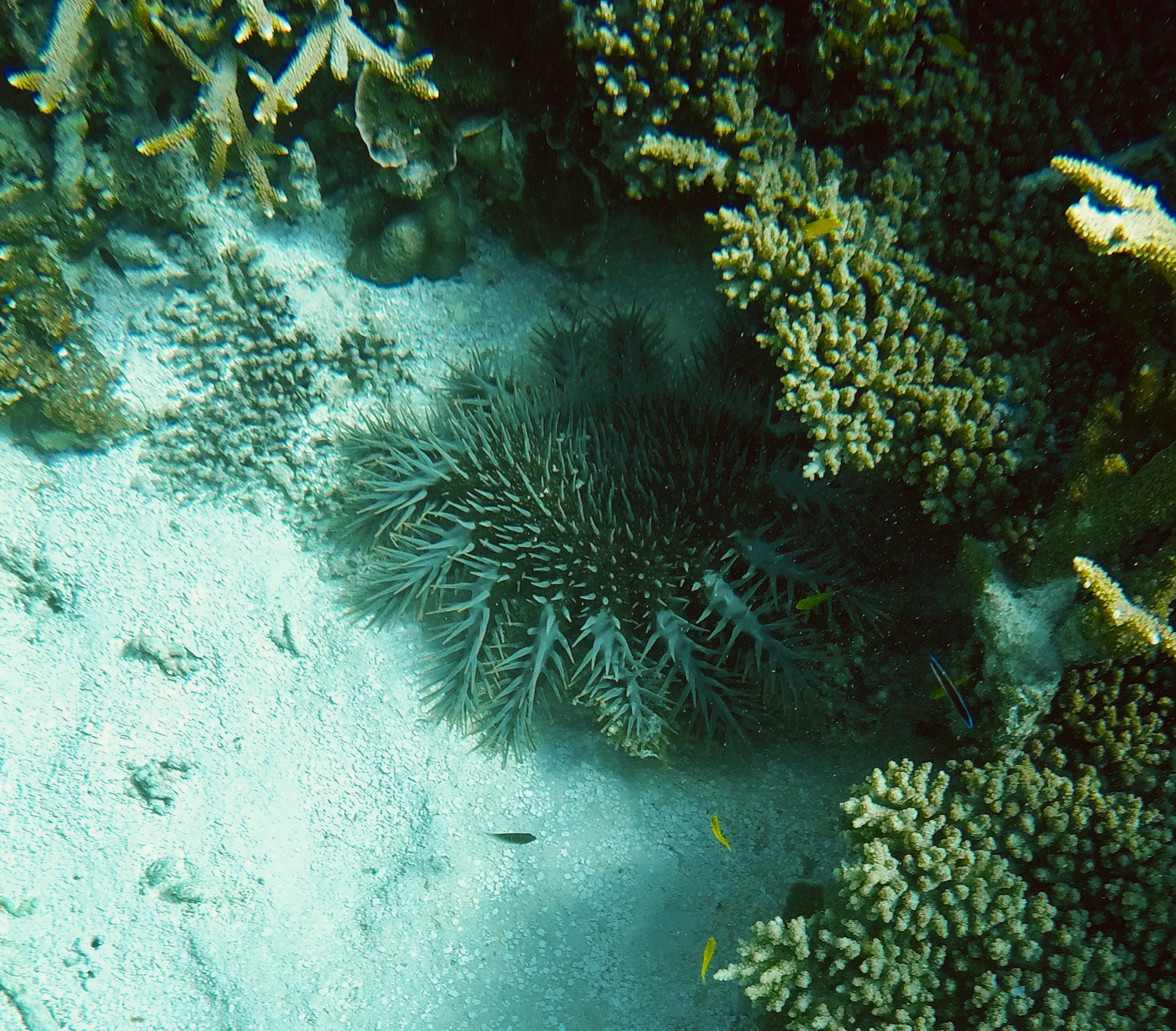
Washing up sick, tired, and a long way from home last month on Newport Beach, a yellow-bellied sea snake may be a harbinger for dramatic changes in Southern California’s waters. The venomous serpent could still be swimming if not for a storm that swept the snake ashore and provided scientists evidence of its incursion. “One might not wash up again this year,” says Greg Pauly, a herpetologist at the Natural History Museum of Los Angeles County. “But one will probably wash up next year.” Are foreign animals in Southern California waters the new normal?
***
Native to the tropical waters of the Indian and Pacific Oceans, the yellow-bellied sea snake differs from other aquatic serpents because of its namesake yellow underside and its paddle-shaped tail that propels it through the water. They are the only sea snake species that inhabits the open ocean habitat, where they feed exclusively on fish using potent venom. Perfectly built for water, these snakes are virtually doomed on land as they are unable to travel across sand.
The recently discovered sea snake joins four others in California history: three that washed ashore during the winters of 2015 and 2016, and one from 1972. Stranded on the beach and sick from cold water temperatures, the snake was euthanized and brought to Pauley to join the other wayward sea snakes at the Natural History Museum. It is now curled up in a jar of alcohol in the museum’s basement.

The 2018 yellow-bellied sea snake specimen.
What makes this particular snake noteworthy is that it washed up in a non-El Nino year. El Nino is a climate phenomenon when warmer water and different currents occasionally carry creatures adrift. Pauly believes that these snakes are beginning to arrive during non-El Nino years, when water temperatures are too cold for them to digest food, because they are extending their range north along the Baja California peninsula. As more snakes inhabit this area, they are susceptible to being picked up by surface currents and carried north. This is likely what happened to the Newport Beach snake.
Are sea snakes arriving in our waters the new normal? Greg Pauly believes it could be likely. “My expectation is that this is going to be an increasing occurrence now that snakes are washing up in non-El Nino years.” However, the existence of these seagoing reptiles are not the only signs of change in Southern California’s warming waters.
***
The reason why sea snakes washing up on Southern California’s beaches is newsworthy is because it hardly ever happens. The water here should be too cold for them. But the world’s oceans are in the midst of unnatural temperature fluctuation.
Although the earth has been experiencing accelerated climate change for centuries, the temperatures in the Pacific Ocean experienced a dramatic spike in 2014. This area of increased temperatures stretches down the Pacific coast and out some 125 miles into the ocean and has been dubbed the “Blob.” Certain areas of the Blob are up to 10 degrees (Fahrenheit) warmer than average, according to a study that mapped the Blob from 2014 to 2016. A warming event of this magnitude in such a short period of time is unprecedented.
Kirk Lynn, an environmental scientist at the California Department of Fish and Wildlife, believes that water temperatures are beginning to level off, citing the latest California Current Integrated Ecosystem Assessment (CCIEA) Report. But there is no denying the damage that warming waters have done to the ecosystems of the Pacific coast. The Blob is tied to mass California sea lion die-offs as well as a deadly algal bloom that stretched the entire West coast. That 2015 bloom caused several commercial fisheries to temporarily shutter and killed approximately thirty whales that migrated through it.

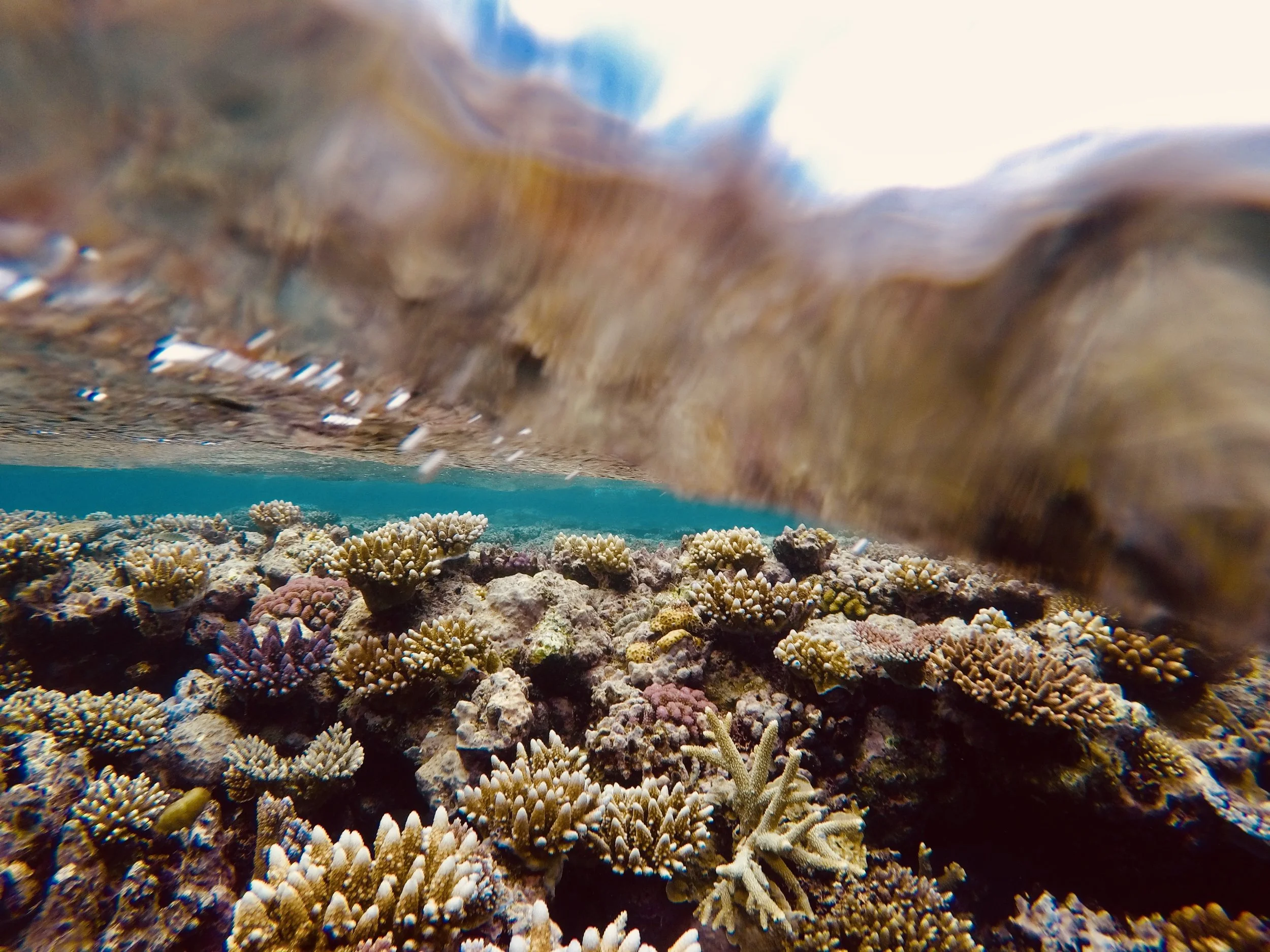
The view from above the surface of a kelp forest along California’s Palos Verdes Peninsula.
The main culprit for the Blob’s warmer waters is a lack of upwelling in coastal areas. Through the use of satellite monitoring, scientists found that the winds along California have weakened. As a result, not enough of the deep, nutrient-rich water is being thrust up by these winds to cool the unusually warm water. Lynn stresses that the lack of upwelling is merely a case of seasonal climate patterns gone to the extreme. “Neither the ‘Blob’ nor El Nino events are part of global warming, and oceanic conditions are returning to neutral states,” he says. But regardless of what’s driving this trend, the lack of upwelling can have disastrous effects on the whole marine ecosystems.

A horn shark swims through the kelp forest exhibit at the Birch Aquarium at Scripps Institute of Oceanography in San Diego.
The plight of kelp forests is a prime example. Without upwelling bringing cool water and nutrients, giant kelp languishes in warm surface water while ravenous urchins, whose populations have exploded as predatory sea stars struggle in warming waters, eat away at its stalk. In Northern California, bull kelp forests that once extended along the coasts for miles have been mowed down by the urchins. The wasteland left in their wake provides a grim look at what Southern California’s already-declining kelp forests may soon look like.
Into this warming environment arrives the yellow-bellied sea snake and a whole slew of other exotic creatures. According to Lynn, species typically seen off of Mexico, like whale sharks and manta rays, have been reported off the Channel Islands. Lynn also notes that “Juvenile white sharks have lingered in Orange County surf zones past their normal stay during summer months,” a frightening thought for some residents. Additionally, subtropical brown boobies, a seafaring bird that dive-bombs for fish, were recently spotted nesting for the first time in the Channel Islands.
While foreign sharks and sea snakes generate headlines, perhaps the bigger, and more perplexing, change in Southern California’s water is the shifting population of anchovies and sardines, which serve both as the backbone of California’s prosperous fishing industry and a key cog in the marine food web.
Diane Pleschner-Steele is the executive director of California Wetfish Producers Association, a nonprofit organization that promotes the sustainable use of California’s pelagic fisheries and cooperative research. In 2014, her organization helped assist with the Southern California Coastal Pelagic Species Survey (CPS) conducted by Lynn and other California Fish and Wildlife Service scientists. The study, which aimed to gain information about the abundance of certain fish stocks in Southern California waters, is a great resource to view larger population trends.
Pleschner-Steele believes that we have entered “uncharted waters” when it comes to anchovies and sardines. “The old hypothesis was that sardines prefer warmer waters and anchovies prefer colder waters” she said. But the years after the 2014 study have presented “highly anomalous” results that turned prior knowledge on its head. The population of anchovies thought to prefer colder water has “mushroomed, notwithstanding the Blob,” according to Pleschner-Steele. Equally confounding is that fishermen reported “an abundance of both sardine and anchovy in the same time and space,” despite their preferences for different habitats.
The big question now is to figure out what these trends mean. The fishery data for anchovy and sardines possibly point to an ecosystem in flux as the fish respond to warming water differently than scientists predicted. But Pleschner-Steele is not quick to jump to conclusions: “The jury is still out: I think it’s too soon to make meaningful, or accurate, sense of this. We need to keep monitoring closely and document environmental forces that’s influencing behavior.”
While short term variations, like El Nino conditions, may affect our marine ecosystems in the present, sea temperature rise is a long-term trend that we cannot fully grasp quite yet. As Pleschner-Steele remarks, the ocean is too complicated “to know if this is the new normal.”
We cannot precisely predict what Southern California’s marine ecosystems will look like over the next few decades, but perplexing fishery trends and the influx of nonnative species gives us a glimpse of what the future could hold. While it is unlikely that a large population of sea snakes will call California home anytime soon, their existence off our coast tells us something about a changing environment. We would be wise to listen.

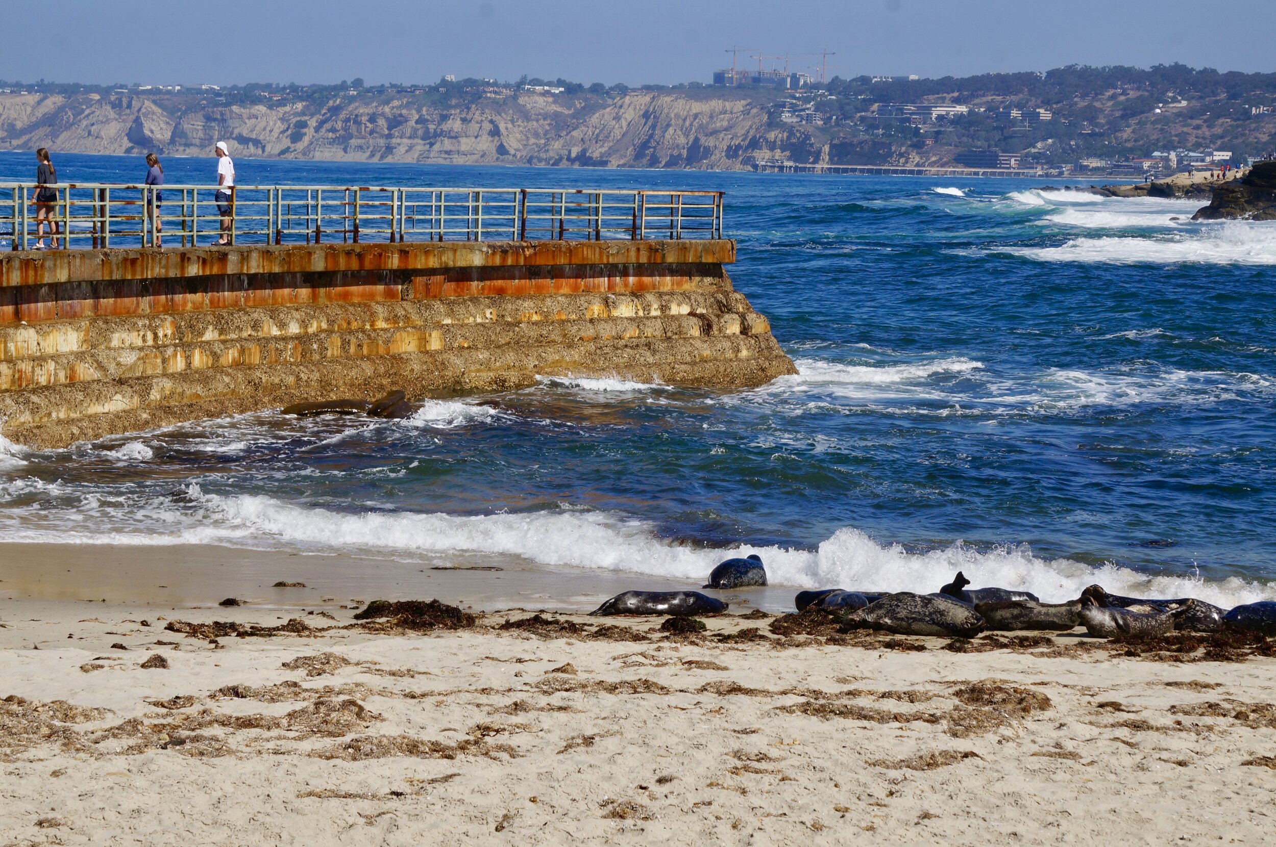
The swell of the Pacific off La Jolla, California.
All Pictures by Jack Tamisiea. Special thanks to Greg Pauly, Kirk Lynn and Diane Pleschner-Steele for taking the time to answer my questions.
Similar Articles: