California

From the Archives: Yellow-Bellied Serpents of the Warm-Watered Reckoning

The 2018 yellow-bellied sea snake at the Los Angeles County Museum of Natural History.

The 2018 yellow-bellied sea snake at the Los Angeles County Museum of Natural History.

Note: this piece was originally written in February 2018 for the University of Southern California’s Annenberg Science Desk. It was revised in February 2021.

Washing up sick, tired, and a long way from home last month on Newport Beach, a yellow-bellied sea snake may be a harbinger for dramatic changes in Southern California’s waters. The venomous serpent could still be swimming if not for a storm that swept the snake ashore and provided scientists evidence of its incursion. “One might not wash up again this year,” says Greg Pauly, a herpetologist at the Natural History Museum of Los Angeles County. “But one will probably wash up next year.” Are foreign animals in Southern California waters the new normal?

***

Native to the tropical waters of the Indian and Pacific Oceans, the yellow-bellied sea snake differs from other aquatic serpents because of its namesake yellow underside and its paddle-shaped tail that propels it through the water. They are the only sea snake species that inhabits the open ocean habitat, where they feed exclusively on fish using potent venom. Perfectly built for water, these snakes are virtually doomed on land as they are unable to travel across sand.

The recently discovered sea snake joins four others in California history: three that washed ashore during the winters of 2015 and 2016, and one from 1972. Stranded on the beach and sick from cold water temperatures, the snake was euthanized and brought to Pauley to join the other wayward sea snakes at the Natural History Museum. It is now curled up in a jar of alcohol in the museum’s basement.

The 2018 yellow-bellied sea snake specimen.

The 2018 yellow-bellied sea snake specimen.

What makes this particular snake noteworthy is that it washed up in a non-El Nino year. El Nino is a climate phenomenon when warmer water and different currents occasionally carry creatures adrift. Pauly believes that these snakes are beginning to arrive during non-El Nino years, when water temperatures are too cold for them to digest food, because they are extending their range north along the Baja California peninsula. As more snakes inhabit this area, they are susceptible to being picked up by surface currents and carried north. This is likely what happened to the Newport Beach snake.

Are sea snakes arriving in our waters the new normal? Greg Pauly believes it could be likely. “My expectation is that this is going to be an increasing occurrence now that snakes are washing up in non-El Nino years.” However, the existence of these seagoing reptiles are not the only signs of change in Southern California’s warming waters.

***

The reason why sea snakes washing up on Southern California’s beaches is newsworthy is because it hardly ever happens. The water here should be too cold for them. But the world’s oceans are in the midst of unnatural temperature fluctuation.

Although the earth has been experiencing accelerated climate change for centuries, the temperatures in the Pacific Ocean experienced a dramatic spike in 2014. This area of increased temperatures stretches down the Pacific coast and out some 125 miles into the ocean and has been dubbed the “Blob.” Certain areas of the Blob are up to 10 degrees (Fahrenheit) warmer than average, according to a study that mapped the Blob from 2014 to 2016. A warming event of this magnitude in such a short period of time is unprecedented.

Kirk Lynn, an environmental scientist at the California Department of Fish and Wildlife, believes that water temperatures are beginning to level off, citing the latest California Current Integrated Ecosystem Assessment (CCIEA) Report. But there is no denying the damage that warming waters have done to the ecosystems of the Pacific coast. The Blob is tied to mass California sea lion die-offs as well as a deadly algal bloom that stretched the entire West coast. That 2015 bloom caused several commercial fisheries to temporarily shutter and killed approximately thirty whales that migrated through it.

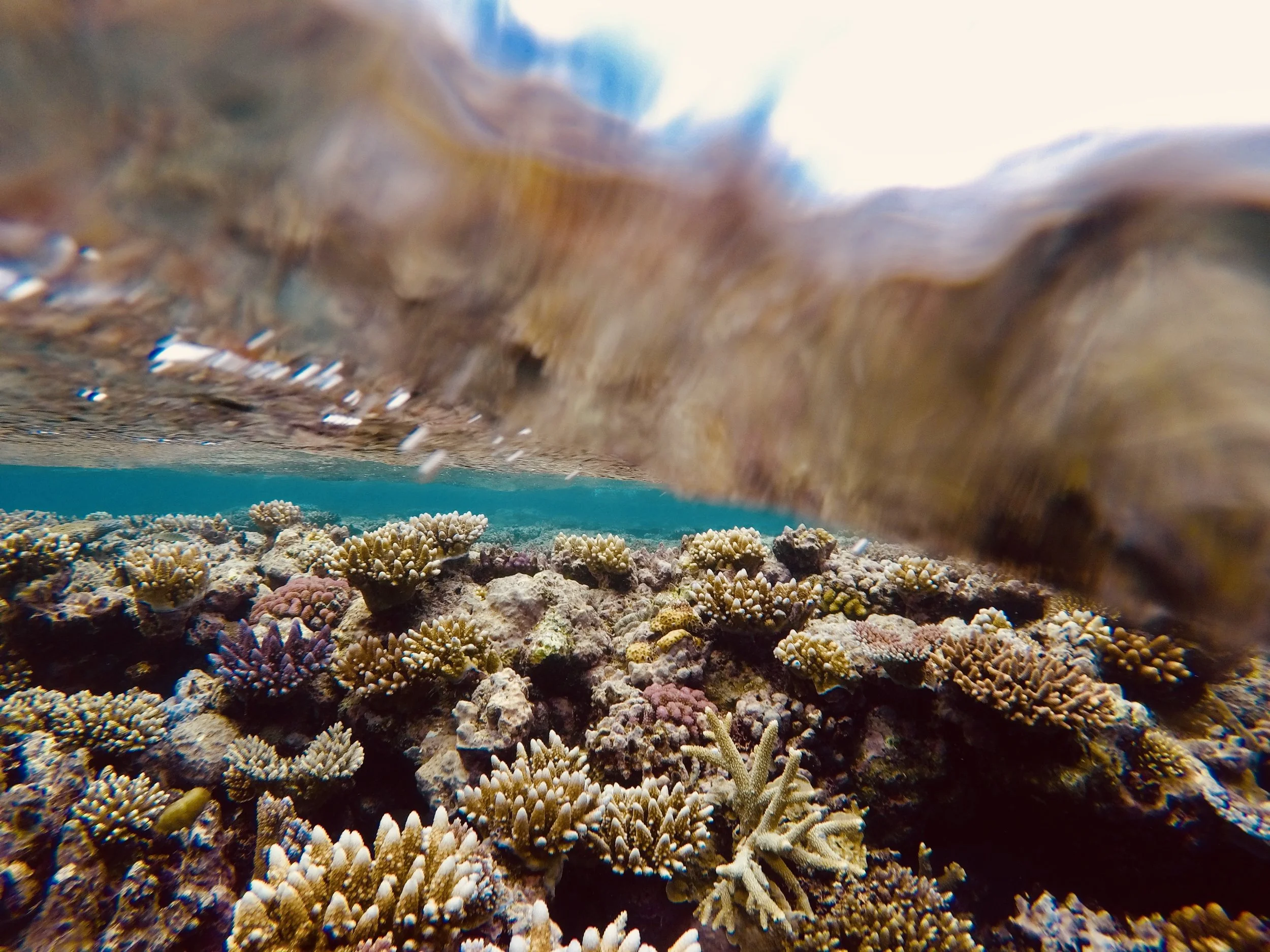
The view from above the surface of a kelp forest along California’s Palos Verdes Peninsula.

The view from above the surface of a kelp forest along California’s Palos Verdes Peninsula.

The main culprit for the Blob’s warmer waters is a lack of upwelling in coastal areas. Through the use of satellite monitoring, scientists found that the winds along California have weakened. As a result, not enough of the deep, nutrient-rich water is being thrust up by these winds to cool the unusually warm water. Lynn stresses that the lack of upwelling is merely a case of seasonal climate patterns gone to the extreme. “Neither the ‘Blob’ nor El Nino events are part of global warming, and oceanic conditions are returning to neutral states,” he says. But regardless of what’s driving this trend, the lack of upwelling can have disastrous effects on the whole marine ecosystems.

A horn shark swims through the kelp forest exhibit at the Birch Aquarium at Scripps Institute of Oceanography in San Diego.

A horn shark swims through the kelp forest exhibit at the Birch Aquarium at Scripps Institute of Oceanography in San Diego.

The plight of kelp forests is a prime example. Without upwelling bringing cool water and nutrients, giant kelp languishes in warm surface water while ravenous urchins, whose populations have exploded as predatory sea stars struggle in warming waters, eat away at its stalk. In Northern California, bull kelp forests that once extended along the coasts for miles have been mowed down by the urchins. The wasteland left in their wake provides a grim look at what Southern California’s already-declining kelp forests may soon look like.

Into this warming environment arrives the yellow-bellied sea snake and a whole slew of other exotic creatures. According to Lynn, species typically seen off of Mexico, like whale sharks and manta rays, have been reported off the Channel Islands. Lynn also notes that “Juvenile white sharks have lingered in Orange County surf zones past their normal stay during summer months,” a frightening thought for some residents. Additionally, subtropical brown boobies, a seafaring bird that dive-bombs for fish, were recently spotted nesting for the first time in the Channel Islands.

While foreign sharks and sea snakes generate headlines, perhaps the bigger, and more perplexing, change in Southern California’s water is the shifting population of anchovies and sardines, which serve both as the backbone of California’s prosperous fishing industry and a key cog in the marine food web.

Diane Pleschner-Steele is the executive director of California Wetfish Producers Association, a nonprofit organization that promotes the sustainable use of California’s pelagic fisheries and cooperative research. In 2014, her organization helped assist with the Southern California Coastal Pelagic Species Survey (CPS) conducted by Lynn and other California Fish and Wildlife Service scientists. The study, which aimed to gain information about the abundance of certain fish stocks in Southern California waters, is a great resource to view larger population trends.

Pleschner-Steele believes that we have entered “uncharted waters” when it comes to anchovies and sardines. “The old hypothesis was that sardines prefer warmer waters and anchovies prefer colder waters” she said. But the years after the 2014 study have presented “highly anomalous” results that turned prior knowledge on its head. The population of anchovies thought to prefer colder water has “mushroomed, notwithstanding the Blob,” according to Pleschner-Steele. Equally confounding is that fishermen reported “an abundance of both sardine and anchovy in the same time and space,” despite their preferences for different habitats.

The big question now is to figure out what these trends mean. The fishery data for anchovy and sardines possibly point to an ecosystem in flux as the fish respond to warming water differently than scientists predicted. But Pleschner-Steele is not quick to jump to conclusions: “The jury is still out: I think it’s too soon to make meaningful, or accurate, sense of this. We need to keep monitoring closely and document environmental forces that’s influencing behavior.”

While short term variations, like El Nino conditions, may affect our marine ecosystems in the present, sea temperature rise is a long-term trend that we cannot fully grasp quite yet. As Pleschner-Steele remarks, the ocean is too complicated “to know if this is the new normal.”

We cannot precisely predict what Southern California’s marine ecosystems will look like over the next few decades, but perplexing fishery trends and the influx of nonnative species gives us a glimpse of what the future could hold. While it is unlikely that a large population of sea snakes will call California home anytime soon, their existence off our coast tells us something about a changing environment. We would be wise to listen.

The swell of the Pacific off La Jolla, California.

The swell of the Pacific off La Jolla, California.

All Pictures by Jack Tamisiea. Special thanks to Greg Pauly, Kirk Lynn and Diane Pleschner-Steele for taking the time to answer my questions.

Similar Articles:

A Naturally Curious Road Trip Part 1: Some Really Big Trees in the Golden State

Exploring Mount Hollywood’s dazzling flowers, Big Sur’s monster seals and John Muir’s “Forest Masterpieces” in the nation’s 31st state.

Sequoia National Park’s Giant Forest

Sequoia National Park’s Giant Forest

From June 6 to June 18, 2020, I drove from Los Angeles, California to Chicago, Illinois in a Buick Enclave. The car, filled to the brim with my college possessions, took me over 4,000 miles up the Pacific Coast, through the Sierras and Rockies, and across the Great Plains. It traversed the roads of ten different states and coasted along the scenic byways of six national parks. Along the way, we drove by Johnny Cash’s home in Casitas Springs, California and John Wayne’s birthplace in Winterset, Iowa. We visited tributes to iconic generals from Grant to Custer. We marveled at the world’s largest tree, reminisced over ancient history at one of the planet’s premier fossil sites, and braved the country’s highest paved road. We came across stately bull moose, emerald pools surrounded by red cliffs, scurrying prairie dogs, homemade apple pie, the world’s only corn palace, dinosaur tracks, a giant rock protruding out of the sea, “thunder beasts,” a double rainbow and the stuffed remains of the mythic jackalope among many other things. Climb in and buckle up as we embark on the Natural Curios Road Trip!

Flowers (and Quail) On the Trek to the Hollywood Sign

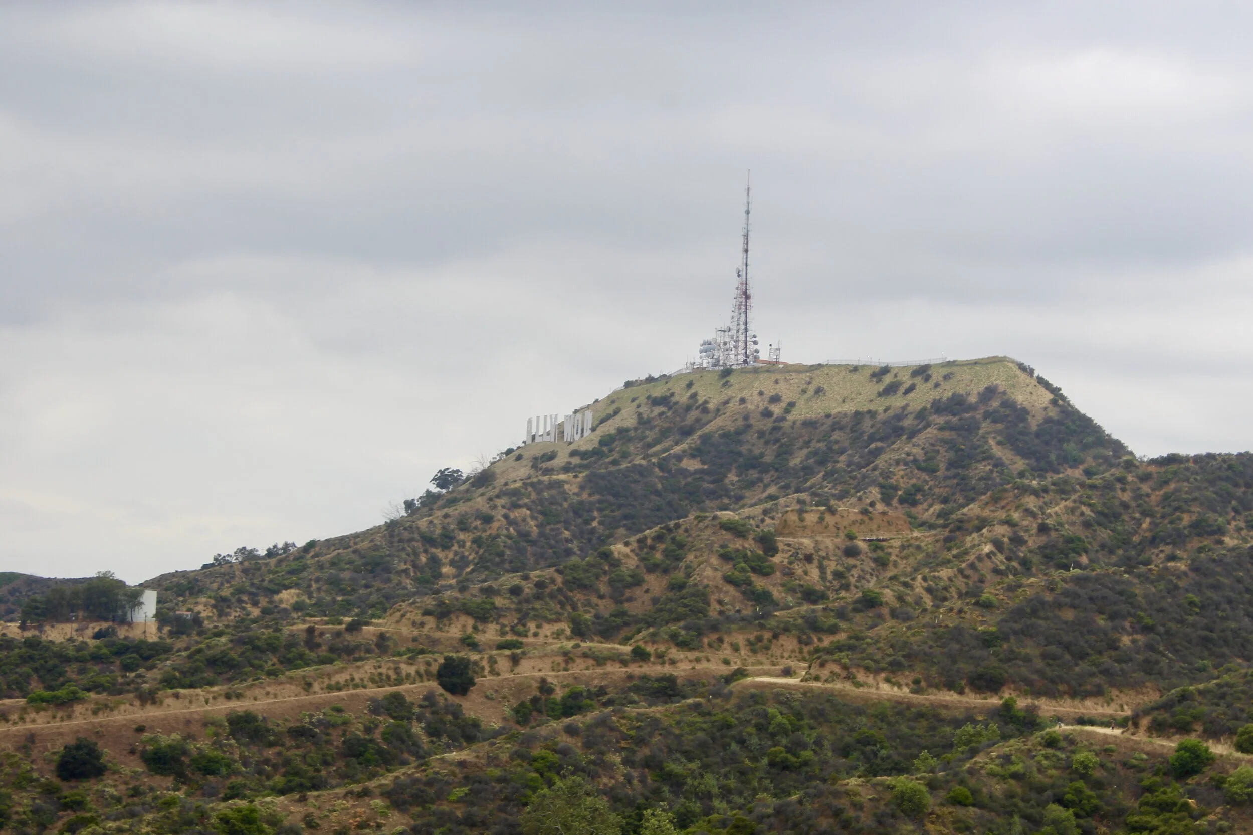
The less glamorous side of the Hollywood Sign. Nevertheless, this angle also captures the skyscrapers of downtown and Griffith Park’s other iconic landmark, the Griffith Observatory.

The less glamorous side of the Hollywood Sign. Nevertheless, this angle also captures the skyscrapers of downtown and Griffith Park’s other iconic landmark, the Griffith Observatory.

The reason for my visit to Los Angeles, the point of origin for our odyssey across the West, was to move out of the apartment that I lived in for 3/4 of my senior year at the University of Southern California. I was also able to visit friends that I had not seen since the coronavirus curtailed our school year in mid-March and enjoy the California sunshine for one final week. The day before I packed the car and pushed off up the California coast to begin the long journey home, I decided to do something that I had once considered a requisite of living in Los Angeles—hike to the Hollywood Sign.

Erected in 1923 as a real estate advertisement, the sign originally spelled out “HOLLYWOODLAND” in 30-foot-wide, 43-foot-tall metal letters. Originally intended to last only a year and a half, the sign quickly became iconic, ditching the “LAND” at the end in 1949. Like most aging stars in L.A., the sign received an extensive face lift in the 70’s, restoring it back to its original splendor from the golden age of cinema. It’s perched near the top of Mount Lee, surrounded by over 4,000 acres of Griffith Park.

Like a few of my adventures, this one was spur of the moment and I began my ascent up the Mt. Hollywood trail without a very clear indication of the length of the trail. I had seen pictures of people on top of the Hollywood Sign pop up on my Instagram feed for years. “I could climb up there in no time,” I thought.

fullsizeoutput_5514.jpeg

You can imagine my dismay when I scaled Mt. Hollywood, a much steeper hike than I had envisioned, and found the Hollywood Sign fastened to a distant peak. It turns out I had only arrived at a viewpoint for the famed logo of Tinseltown. After another hour of wandering on dirt trail and roads, with some unintended detours through thick brush, I finally arrived at the top of the Hollywood Sign. Beyond the towering white letters lied the park’s other iconic landmark, the Griffith Observatory, and the sprawling expanse of Los Angeles unfolding in every direction.

Through my accidental backpacking trip through Griffith Park, I stumbled across a blanket of wildflowers. Or more accurately, I had to maneuver through the flowery brush as I climbed, careful not to inadvertently squash any of them. Their lush beauty seemed to be out of place in the middle of such a manicured city like Los Angeles where even the river is paved. This is part of the appeal of Griffith Park, the eleventh largest municipally-owned park in the country that lies in the Santa Monica Mountains. Named after a mining and real estate mogul whose first and last name were both Griffith, the urban wilderness the park offers covers a stretch of habitats from deep canyon wetlands to the forests that grow near the mountaintops. When I visited in early June, the dirt trails were decorated with everything from bright oranges and reds to the palest shade of violet possible. One particularly beautiful flower, called the Plummer’s Mariposa Lily, looked like a dusty golden flower whose pedals had been dipped in bright periwinkle paint. Another orange flower has the amusing moniker of the orange bush monkeyflower.

A California quail hanging out in the brush.

As I was admiring all of the flowers in the thick carpet that surrounded me, I encountered probably the most interesting looking bird I have ever seen in Los Angeles. Sporting a drooping pompadour-like crest slightly reminiscent of Elvis, the California quail is a plump bird that spends most of its time fixed to the ground. California’s state bird is a popular game species (it has been introduced to places as far away as New Zealand) and releases a loud Chi-ca-go call. This call was a peculiar reminder of how far I had to go over the next two weeks.

Up The Coast To Big Sur

The following day, my calves still aching from the meandering climb through Hollywood’s hills, I picked up my Mom at the airport (unfortunately I was a bit tardy after a preceding late night) and we headed up the coast to Big Sur, one of the most iconic drives in the entire country. Although the actual boundaries of Big Sur are hazy, the 70 mile stretch of California State Route 1 from San Simeon in the south up to Carmel-by-the-Sea in the north is generally the consensus area. Here the rugged coast remains wild, protected by the Los Padres National Forest and Pfieffer Big Sur State Park.

Starting in Los Angeles, we had to approach the iconic drive from the south, passing through the Southern portion of the Los Padres National Forest towards Santa Barbara. While stopping at an overlook, I noticed a large bird flying overhead with a bald, pink head. Initially I was ecstatic, believing we had a sighting of the critically endangered California condor. Alas, this ended up being the condor’s much more common cousin, the turkey vulture. Similar to its larger cousin, the turkey vulture is a scavenger and has adopted its featherless head for this lifestyle. Cleaning off gore and blood is less of a hassle without feathers. Turkey vultures became a staple of our trip, scouring highways from California to South Dakota for tasty roadkill as we whizzed by.

After a pitstop in Santa Barbara, we continued to snake our way up the coast towards Big Sur. At Morro Bay, we took a slight detour to see something too intriguing to pass up: a nearly 600 foot rock protruding out of the Pacific. At 23 million years old and sometimes hailed as the “Gibraltar of the Pacific,” Morro Rock is the remnant of a massive volcano that once dominated this area. When the volcano was active, a large amount of molten magma hardened deep within the volcano and became what is known as a volcanic plug. Over the 23 million years since its formation, the rest of the volcano has become dormant and eroded away, leaving just the volcanic plug behind. For centuries, this plug has been an immense beacon for wayward sailors along the Pacific, eventually becoming known as Morro Rock. Today the rock is a state historic landmark as well as a bird sanctuary that harbors the world’s fastest animal, the peregrine falcon.

After leaving the blustery beach we continued north towards San Simeon, mindful of the hulking form of Morro Rock slowly disappearing in the rearview mirror. The sun was beginning to fall as we pulled into the Piedras Blancas elephant seal rookery. Only smaller than their antarctic cousins, the southern elephant seal, central California’s northern elephant seals are monster pinnipeds. Males can reach up to 16 feet long and weigh more than a Jeep at 5,000 pounds. Female elephant seals, often seen lounging near their larger mates, are only between 8 and 12 feet and weigh up to 1,200 pounds. These seals are named after elephants both because of their staggering size and because males have large, trunk-like noses known as a proboscis. These large schnozes are used to intimidate their rivals through their ability to make thundering challenge calls as they jostle with each other for females (an encounter that often leaves both seals covered in blood).

Several elephant seals lounging along California’s rugged central coast.

Several elephant seals lounging along California’s rugged central coast.

Although none of them were battling for a mate this time of year, they were audible as they wrestled for space on the beach. The late spring and summer is molting season, when these huge seals return from foraging trips that take them as far as Alaska and as deep as 5,000 feet, a record for seals. They spend up to 10 months a year out at sea, hunting small sharks and octopuses at around a thousand feet below the surface. Swimming this deep helps them avoid great white sharks and orcas, the only predators in the sea capable of hunting elephant seals.

The air was full with snorts and growls as I watched the mangy seals go about their afternoon. As they molt, they replace their skin and hair, something we do continuously. Elephant seals, on the other hand, do it all at once for an entire month every year. Their old skin peels off in large, brown sheets. The combination of their floppy noses, shedding skin and enormous size make them seem more at home in a Dr. Seuss book than on the beaches of Big Sur.

Above: Male elephant seals, complete with shedding skin, wrestle at the elephant seal rookery at Piedras Blancas.

Tragically, these beaches were once devoid of elephant seals. In fact, they almost disappeared entirely only a century ago. Similar to whales, elephant seals were aggressively hunted for their oil for decades before the advent of kerosene. Their total population, isolated to a single colony on Mexico’s Guadalupe Island, numbered a mere hundred in the 1920s. After Mexico protected them in 1922, the seal population rebounded on Guadalupe Island and these huge seals eventually made their way back to Southern California, aided by similar protection in the U.S. Today there are 160,000 northern elephant seals in the world, and thousands of them haul out on the beach at Piedras Blancas for the breeding season between December and March each year.

After leaving the elephant seals to molt in peace, we continued along the coast into Big Sur proper. Before we drove too far up the road, we saw a few cars parked along the road opposite the ocean. We slowed down just long enough to make out two elk, each brandishing a large rack of antlers, trudging up a hillside.

Spot the elk! There are two tule elk in this picture taken near the elephant seal rookery at Piedras Blancas.

Spot the elk! There are two tule elk in this picture taken near the elephant seal rookery at Piedras Blancas.

Similar to elephant seals, tule elk almost disappeared entirely. Less than 30 of this subspecies of elk endemic to California were believed to exist in the 1870s because of overhunting and habitat loss related to cattle ranching. One of these cattle ranchers, however, had the foresight to preserve the remaining herd and all of the nearly 6,000 tule elk that exist today, including the two we saw in Big Sur, are descended from the final herd of 30. Both tule elk and elephant seals are conservation success stories that illustrate that it is almost never too late to bring species back from the brink of extinction.

As the sinking sun’s golden rays glowed as they bounced off the Pacific, we made our way into Pfeiffer State Park—the wild heart of Big Sur. California Route 1 narrows into two lanes as it becomes sandwiched between the Santa Lucia Mountains and the ocean far below where the road winded along the cliffs. Deeper in Pfeiffer Park, groves of California redwoods, the world’s tallest tree, tower well over 300 feet into the California sky. Content with our plans to gape at humongous trees the next day, we continued north towards Monterey.

Above: Some scenes from the road through Big Sur.

The view after every hairpin turn (and there were a lot of them) was somehow more picturesque than the last as I stopped often to take pictures of the sun plunging towards the horizon. Giant rocks, similar to Morro Rock (albeit on a smaller scale) jutted out of the water far below, tossing foam up as the waves continued their endless assault. You would be hard pressed to find a scene that epitomized California more than this.

The Divine Majesty of Really Big Trees

Standing 275 feet tall and measuring over 36 feet wide at its base, the General Sherman tree in Sequoia National Park’s aptly named Giant Forest is truly one of nature’s greatest wonders. Containing over 52,000 cubic feet of wood, it is not only the world’s largest tree. It is the largest living thing on the planet!

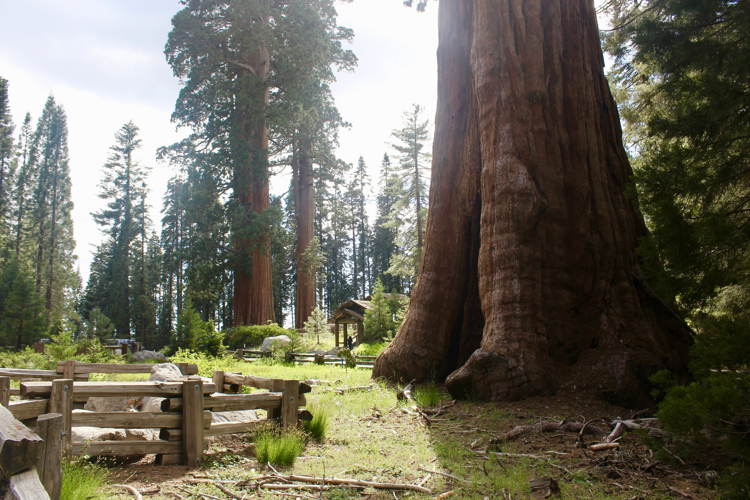
The gnarled trunk of General Sherman, the world’s largest tree.

The gnarled trunk of General Sherman, the world’s largest tree.

All together, Sequoia’s Giant Forest is home to thousands of gargantuan sequoias, many of which rival the mighty General Sherman in sheer size. The trees in this area, perched on the Western slopes of the Southern Sierra Nevada Mountains, was the impetus behind creating the country’s second national park in 1890, a full 26 years before the advent of the National Park Service. John Muir, a Scottish-American naturalist and future co-founder of the environmental organization the Sierra Club, gave the Giant Forest its name and was crucial in establishing this area for protection. He summed up the awe-inspiring role of sequoias, which he often referred to simply as “Big Trees”, in his writings: “Sequoias towering serene through the long centuries preaching God’s forestry fresh from heaven.”

John Muir visited this grove in 1875 and was rightfully blown away by the sheer size of the sequoias here. “This part of the sequoia belt seemed to me the finest, and I then named it ‘Giant Forest’.”

John Muir visited this grove in 1875 and was rightfully blown away by the sheer size of the sequoias here. “This part of the sequoia belt seemed to me the finest, and I then named it ‘Giant Forest’.”

We arrived to Sequoia National Park the day after our sojourn along the California coast. What awaited us here was a far different California natural marvel: intact groves of sequoias high up in the mountains. But before we could walk among giants, absorbing their lessons of “God’s forestry,” we had to climb into the Sierras on the Park’s main road, the Generals Highway. Sequoia National Park tripled in size shortly after achieving protection in 1890, making it one of the largest national parks in the country. In addition to towering trees, the park also boasts the highest point in the contiguous United States at the peak of 14,505 foot tall Mount Whitney, and is next-door neighbors with the smaller Kings Canyon National Park, an area known for both groves of sequoias and its namesake canyon that plunges a mile below the surrounding peaks, the handiwork of a glacier that once tore through this area. Needless to say, there is an incredible amount to see in this area of California, but we had our sites set on visiting the sequoias three thousand feet above our car as we entered the park.

Above: Dug out by the Civilian Conservation Corps during the Depression in the 1930s, Tunnel Rock once hung over the main road into the park. Today only hikers, not automobiles, use Tunnel Rock.

fullsizeoutput_556e.jpeg

Generals Highway winds its way into the mountains, reminiscent of California State Route 1. It offers ample opportunities for stunning views of the Middle Fork River that sliced through the Sierras far below (right). Eventually we lost sight of the river as we entered the dense forests that cloaked the mountains. The temperature outside the car plummeted by almost 30 degrees Fahrenheit (F) to 45 F. We had entered a new world.

At last we saw one! Turning around a bend in the road, the broad, rust-red trunk of a sequoia clogged our windshield. Sequoias continued to pop up along the drive, each one seemingly larger than the last until we pulled into the Giant Forest parking lot and decided to take a look at them up close. Giant sequoias (Sequoiadendron giganteum) are one of three species of redwoods, the group that constitutes the giants of the tree world. California’s other species of redwood are the aforementioned coastal redwood (Sequoia sempervirens) found in Big Sur. A particularly lanky coastal redwood that resides further up the coast in Redwood National Park is almost 380 feet tall, over a hundred feet taller than General Sherman! However, sequoias have much more girth than coastal redwoods as they maintain large trunk widths well up into the air like a column. If you were to measure the width of General Sherman sixty feet above its base, the tree would still be over 17 feet wide.

General Sherman stays wide even as it soars towards the top of the Giant Forest.

General Sherman stays wide even as it soars towards the top of the Giant Forest.

The Sentinel tree (foreground) weighs more than two jumbo jets…and it is still just an average-sized sequoia!

The Sentinel tree (foreground) weighs more than two jumbo jets…and it is still just an average-sized sequoia!

Both coastal redwoods and sequoias can live for an incredibly long time. One sequoia lived for 3,266 years, making them the third longest living tree in the world. General Sherman, estimated to be a spry 2,000 years old, is relatively young compared to some of the other behemoths in its neck of the woods. These venerable trees keep a valuable record of how the climate here has changed over the years in the amount of space between each of its age rings (more space between rings means more moisture as it helps the trees grow). The trees’ ancient aura also transports you to prehistory when gigantic forests like these were common around the world. Walking around Giant Forest, you constantly expect to see a sauropod dinosaur plod out of the dense forest, straining its long neck to reach the lower branches that bristle with pine needles. Sequoia fossils have been found dating as far back as the Cretaceous Period, meaning they cropped up during the dinosaurs’ last stand.

Above: Fallen giants are strewn around the Giant Forest, offering a poignant glimpse into what these groves looked like thousands of years ago.

The mountain yellow-legged frog of the Sierras.

The mountain yellow-legged frog of the Sierras.

Although nothing as big as dinosaurs lives here today, the park is still bursting with wildlife. Over 200 birds, including the California quail, either live here or stop here along migrations. Black bears roam around the park, always a threat to tear apart someone’s car after a whiff of snack food. Sequoia and Kings Canyon are also the sites of potential wildlife conservation victories. Bighorn sheep have been re-introduced here and endangered mountain yellow-legged frogs are making a comeback thanks to an effort to remove trout from several of the alpine lakes in the park. The fish, introduced by humans hoping to entice anglers to flock here, nearly wiped out the frogs by eating their tadpoles and out-competing them for insect prey. Although many trout have been removed here, the arrival of chytrid fungus poses an even bigger risk to the mountain yellow-legged frog in the future.

The potential demise of the mountain yellow-legged frog, despite a valiant trout-removal effort, hints at the environmental scars still present in the shadows of the sequoias. The last California grizzly bear was spotted in the park near Generals Highway in 1924. Two years before that, a grizzly was shot nearby. That turned out to be the last confirmed grizzly bear kill in the state where they only endure on the flag. Many of the sequoias, thousands of years old, have deep, jet-black fire scars. Although sequoias are adapted to sporadic flames, even relying on fire to clear the underbrush for saplings to take root, a warming climate may create longer and more intense fire seasons that could harm even these giants. A prolonged drought between 2012 and 2016 related to higher temperatures contributed to the mortality of 40 giant sequoias as the lack of available moisture exacerbated other issues the trees were facing like disease. Giant sequoias may seem impenetrable when you touch their thick, spongy bark or gaze up at their soaring crowns but they prefer a particular climate where winter temperatures drop to about 10 F and summer temperatures do not exceed 85 F. As the earth continues to warm, will John Muir’s big trees be one of the casualties?

A close-up of the bark of a mighty sequoia.

A close-up of the bark of a mighty sequoia.

The next day, our last in California, we left early to visit Grant Grove, a sequoia grove in Kings Canyon National Park. Similar to General Sherman, the star attraction here is a colossal tree named after another Civil War Union hero, Ulysses S. Grant. (It is worth noting that Sequoia and Kings Canyon recently took action to remove the names of two trees named in honor of Confederate General Robert E. Lee. Similar to the General Sherman tree, these two trees were named by early settlers who served under him in the Civil War.) Designated as the nation’s Christmas Tree by President Calvin Coolidge in 1926, the General Grant tree is the second largest tree in the world and has a 107 foot circumference around its base!

fullsizeoutput_5577.jpeg

We arrived to Grant Grove early in the morning when the popular trail around the mammoth tree was nearly empty and the temperature was a frigid 36 F. In the shadow of General Grant, we also admired an immense sequoia stump called Fallen Monarch and wandered around Gamlin Cabin, a relic log cabin from 1872 when the owner owned a timber claim here. In the fresh, cold morning air, rays of sunlight filtered through the foliage of the sequoias, many of them taller than a 20-story building. It felt like somewhere I could wander around forever but I knew we must push on. We still had a long way to go and so much to explore. John Muir expressed this sentiment best: “The world is big and I want to get a good look at it before it gets dark.”

Above: Among the giants, including General Sherman, in Sequoia National Park.

All photos (except those that I’m in) and art by Jack Tamisiea.

Afternoon in Death Valley

America’s most inhospitable environment is a surreal geologic wonderland comprised of expansive salt flats, color-stained rocks and weathered badlands. In Death Valley, you will meet singing sand, desert fish and a golf course from hell.

fullsizeoutput_4fa8.jpeg
Half a league onward...Into the valley of Death
Rode the six hundred.
— The Charge of the Light Brigade by Alfred, Lord Tennyson

Why would anyone ever venture into somewhere with the moniker Death Valley? The landscape is desolate, animals (seemingly) scarce, and long stretches of empty roads dot the seemingly infinite landscape. The most daunting aspect of the area is the oppressive summer heat. The world record for atmospheric temperature was recorded here in 1913 at a scorching 134 degrees Fahrenheit (F). If you think that has to be an aberration, think again. The hottest month on record here was July 2018, with a smoldering average of 108 degrees F. 21 days that month reached, or exceeded, 120 degrees. Suffice to say that you do not want to enter Death Valley in the summer months. But that does not mean you should never venture there at all.

Many of Death Valley’s most popular sites for those in a rush are located along State Route 190, the Park’s main, and often empty, road.

Many of Death Valley’s most popular sites for those in a rush are located along State Route 190, the Park’s main, and often empty, road.

Death Valley is a land of extremes, spanning a range of habitats and ecosystems that support some of the hardiest life on earth. In only this park, you can see soaring, snow-capped peaks rise above barren, alien salt flats and windswept sand dunes. Rugged badlands and chemically-stained rocks give this brutal landscape an otherworldly beauty. Even incredible fish live here! Death Valley may be brutal, but it is well worth a visit, as its nearly 1 million visitors a year can attest. Just bring a lot of water and make sure the fuel tank is topped off.

6:30 AM

I head out to Death Valley from Los Angeles on the first day of February, 2020. Death Valley National Park, which received that distinction in 1994, is about 4 hours northeast of Los Angeles, straddling the California-Nevada border deep in the Mojave Desert, the driest desert in America. After slowly slithering through Los Angeles’s never ending “rush hour”, the road opens up around Palmdale. As the cars around me begin to fall behind and out of view, the landscape empties as mountains rise on the sides of the increasingly bumpy and dusty road. After traversing a mountain pass, I descend, and descend, into Panamint Valley, southwest of the Park. I am one of the only cars on this lonely stretch of road as I fly past the lonely sign denoting that you are entering a National Park. You would have no way of knowing otherwise.

11:00 AM

Even though it is not crucial, I top off the tank at a gas station in the tiny town of Panamint Springs, nuzzled just inside of the Park’s border. Death Valley, the largest national park outside of Alaska at a sprawling 3.4 million acres, is no place to be with a dwindling fuel tank. I pick up a map and head into the heart of the park towards the two larger visitor centers at Stovepipe Wells Village and Furnace Creek (aptly named because this is where the ungodly 134 degrees was recorded). Along the way the highway descends again. Through the windshield, however, you can see the highway climb vertically into the Panamint Mountains as I drive towards Stovepipe Wells Village.

11:45 AM

After paying the visitor’s fee and refilling the water bottles, I leave Stovepipe Wells for the Mesquite Dunes. Nothing signifies a desert like towering sand dunes. Some of the dunes here rise a hundred feet high, making them some of the tallest dunes in the Park and by far the most accessible. If you make it to the Eureka Dunes, the park’s largest clump of dunes, keep your ears open for eerie bass notes in the air. This is due to a haunting phenomenon known as singing sand. Although we picture seas of sand when we imagine deserts, under one percent of Death Valley is actually covered with sand dunes.

The constantly shifting sand dunes are covered in ripples etched in the silky sand by wind (especially when I was there, when wind speeds were over 20 miles per hour in some parts of the park). Many people visit around sunrise and sunset to take pictures of the dunes as they’re bathed by the sun’s most vulnerable rays, and some even partake in hikes after the dark when only the moon can guide you over the dunes. Signs in the parking lot warn late visitors to be careful of sidewinder rattlesnakes who emerge from the dunes after dark. These venomous snakes, named for their efficient style of desert locomotion, often sit motionless, with just their eyes and devil-like horns poking above the sand.

The sidewinder is part of one of the many ecosystems that exist in Death Valley, the hottest and driest place on the continent. Elsewhere in the park, isolated wetlands and springs offer an often fleeting view of what this area used to look like thousands of years ago. 15,000 years ago, this hellish “wasteland” would have been submerged by lakes. Hundreds of millions of years ago, it would have been buried beneath glaciers.

The few areas that have managed to stay wet as Death Valley dried out support some of the most hardy species of fish on the planet, collectively known as pupfish. Large swaths of dry desert lie between these tiny bodies of water, which has led to the development of nine different species of pupfish in Death Valley National Park alone. As Darwin discovered thanks to the existence of unique tortoises and finch species on the different Galapagos Islands, isolation kick starts evolution. Isolation here has created unique species like the endangered Devil’s Hole pupfish, which lives in an underwater cave where water temperatures rise above 90 degrees. Despite efforts to preserve the Devil’s Hole pupfish, these tiny, shimmering blue fish (only around 35 mm long as adults) are picky breeders, only reproducing on a shallow shelf in Devil’s Hole before the cave drops another 500 feet into the earth. This phenomenon effectively takes captive breeding out of the equation.

Despite the macabre name, Death Valley is also home to a whole host of other sturdy organisms that not only survive but thrive here. The desert bighorn sheep that scale the Park’s mountain slopes can survive days without water. Taking it one step further, kangaroo rats can survive their whole lives without a drop of water, obtaining the minimal amount of moisture they need from their vegetarian diet. The desert tortoise spends up to 3/4 of its year in its burrow to avoid the Park’s searing heat. Similarly, many species, like bobcats, are nocturnal, avoiding the heat at all costs.

Reptiles, like this desert banded gecko, are some of the most successful creatures inhabiting Death Valley. Like the desert tortoise and banded gecko, many burrow into the ground to avoid the most extreme temperatures. Picture taken at the Phoenix Z…

Reptiles, like this desert banded gecko, are some of the most successful creatures inhabiting Death Valley. Like the desert tortoise and banded gecko, many burrow into the ground to avoid the most extreme temperatures. Picture taken at the Phoenix Zoo.

12:30 PM

The beginning of a trail that enters into the badlands at Zabriskie Point.

The beginning of a trail that enters into the badlands at Zabriskie Point.

After stopping at Furnace Creek to grab a sandwich and some post cards at the visitor’s center, I make my way to Zabriskie Point, one of the most picturesque sites in the entire park. These badlands are composed of sediments from a dried-up ancient lake where camels and mastodons once trudged along the shore. These canyons are the masterpiece of millions of years of erosion, which makes the rocks appear to be covered by a wrinkled blanket. The weathered rocks that form these badlands range in colors from dull gold to mustard yellow to a rich, coffee brown, which indicates that lava once seeped through here from nearby volcanoes some 3-5 million years ago.

A view of Manly Beacon, the point jutting above the rest of the weathered badlands, from the top of Zabriskie Point.

A view of Manly Beacon, the point jutting above the rest of the weathered badlands, from the top of Zabriskie Point.

This location, named after a manager of an early 20th century borax mining company, is best viewed at sunset or sunrise, when the richly-textured rocks glow orange and red. The iconic area has also been pictured on the cover to U2’s critically-acclaimed Joshua Tree album and was the setting for a scene in Stanley Kubrick’s Spartacus as a stand-in for ancient Egypt. As I get back into my car and pull out of the parking lot, Bruce Springsteen’s Badlands serendipitously blares through the radio as I snake back towards the main road, moving past millions of years of time trapped in weathered rocks.

A panoramic view of the badlands taken on my phone at Zabriskie Point.

1:15 PM

After arriving back on State Route 190, my car begins a continual descent towards the bottom of North America. But first I need to visit Artist’s Drive, a scenic drive cutting through a rainbow of rock. Slowly winding through nine miles of eroded cliffs and canyons, the splash of color jumps right out at you and beckons you to pull the car over for a closer look. While Zabriskie’s point exploded with earth tones, Artist’s Palette, the drive’s most famous spot, is a collection of rocks that form a kaleidoscope of bright colors. The colors, which range from mint green to a bright, chalky pink, are the result of the oxidation of chemicals (losing an electron according to high school chemistry) in the ground here. The oxidation of iron, for example, creates red and pink-hued rocks while oxidizing manganese produces the soft purples. This entire formation of colorful rocks was created by a particularly violent volcanic eruption millions of years ago that left enormous amounts of dried lava behind. Millions of years of chemical weathering and the occasional downpour of rain made these colors pop. If you get an eerie sense that you’ve seen Artist’s Drive (and its vivid landscape) before, it may be because the area was featured in the first Star Wars film, 1977’s iconic A New Hope.

Above: Artist’s Palette (first two images) glimmers in the afternoon light, but the rest of Artist’s Drive is not to be overlooked.

2:15 PM

After winding through the rest of Artist’s Drive on the heels of a strategic bathroom break, I again hit the open road destined for Badwater Basin, the lowest point on the continent. The sun was beginning to sink in the sky as I pushed down the lonely road, the wind sweeping dust across the paved highway. But before I descended to rock bottom, an intriguing sign caught my attention. It denoted that the next turn would lead to Devil’s Golf Course. It’s not surprising that Death Valley, as its name suggests, has several grimly-named locations within its boundaries. Hell’s Gate. Desolation Canyon. Dante’s View. But none of these piqued my interest like the Devil’s Golf Course. And it delivered.

Only the Devil would unwind by playing golf here.

Only the Devil would unwind by playing golf here.

Jagged rocks, smothered with crystallized salt, stretch as far as the eye can see. It is said that these rocks are so sharp (and extremely hot most of the year) that only the devil would tee off here. But it is no stretch to imagine that even his cloven hooves being cut up on these razor-like rocks. When the temperature rises, this golf course is filled with subtle sounds of metallic cracking as the salt crystals expand and contract.

3:00 PM

A sign at Badwater Basin denoting the location’s extreme altitude.

Just down the road from the most forbidding golf course in the world is Badwater Basin, one of the most popular sites in the park. Less than 85 miles from the highest point in the continental United States, Badwater Basin is submerged some 282 feet below sea level! The land here is covered in a think blanket of salt, almost 60 inches thick at some points.

Where is all of this salt from? The Badwater Basin salt flat is comprised of salt from an area as large as New Hampshire that trickles down from mountains, carrying minerals with it and eventually landing at the continent’s lowest point. As a result, Badwater Basin is often temporarily covered in water. Near the road is (usually) a small pool of incredibly salty water that gave this area its name when a prospector’s mule refused to drink it. But on the adjacent salt flats, the water never lasts for long. Once it evaporates (the area has the highest rate of evaporation in the country), only the salt is left. Strikingly, the salt flat is covered by hexagonal, honeycomb-shapes, the result of constantly expanding and retracting salt crystals. These shapes only add to the area’s alien feel.

The walkable path extends into the snow-like salt flat for what seems like miles. The salt stretches even further to where it meets the base of the surrounding mountains. As is usually the case, walking too far off the path could result in breaking through the salt (which is only a couple inches thick at some points) into mud below it. Not an ideal way to end a day in Death Valley.

This desolate area was bequeathed with its unwelcoming name by a group of pioneers unfortunate enough to be stranded in this hostile environment in 1849. Although only one of them perished here, another triumphantly exclaimed as they escaped across the surrounding mountains, “Goodbye, Death Valley!” The name stuck. Walking back toward my car after the sun dropped below Badwater Basin’s mountainous backdrop, leaving the salt flat an eerie dark blue, the quietness of this landscape made any comparison to a valley of the dead conceivable.

The Badwater Basin salt flat painted by the rosy-hued rays of light at sunset.

The Badwater Basin salt flat painted by the rosy-hued rays of light at sunset.

5:00

After stopping at Furnace Creek to fuel up, I hit the road in the dying light of dusk. With a full water bottle and a full lineup of podcasts loaded up, I began the arduous journey back to Los Angeles. Before I can pass the Mesquite dunes, the night has already swallowed up the park. Blackness engulfs everything save the area right in front of my headlights. Occasionally, headlights pop up miles in front or behind me as I exit the park. Every so often, I looked up at the most exquisite canvas of stars I have ever seen.

In the mystical moist night-air, and from time to time,
Look’d up in perfect silence at the stars.
— When I Heard the Learn'd Astronomer by Walt Whitman

La Jolla's Seal Problem

Many people love the presence of seals and sea lions along La Jolla’s coast. But others view them as a nuisance that has robbed them of a beloved local swimming spot.

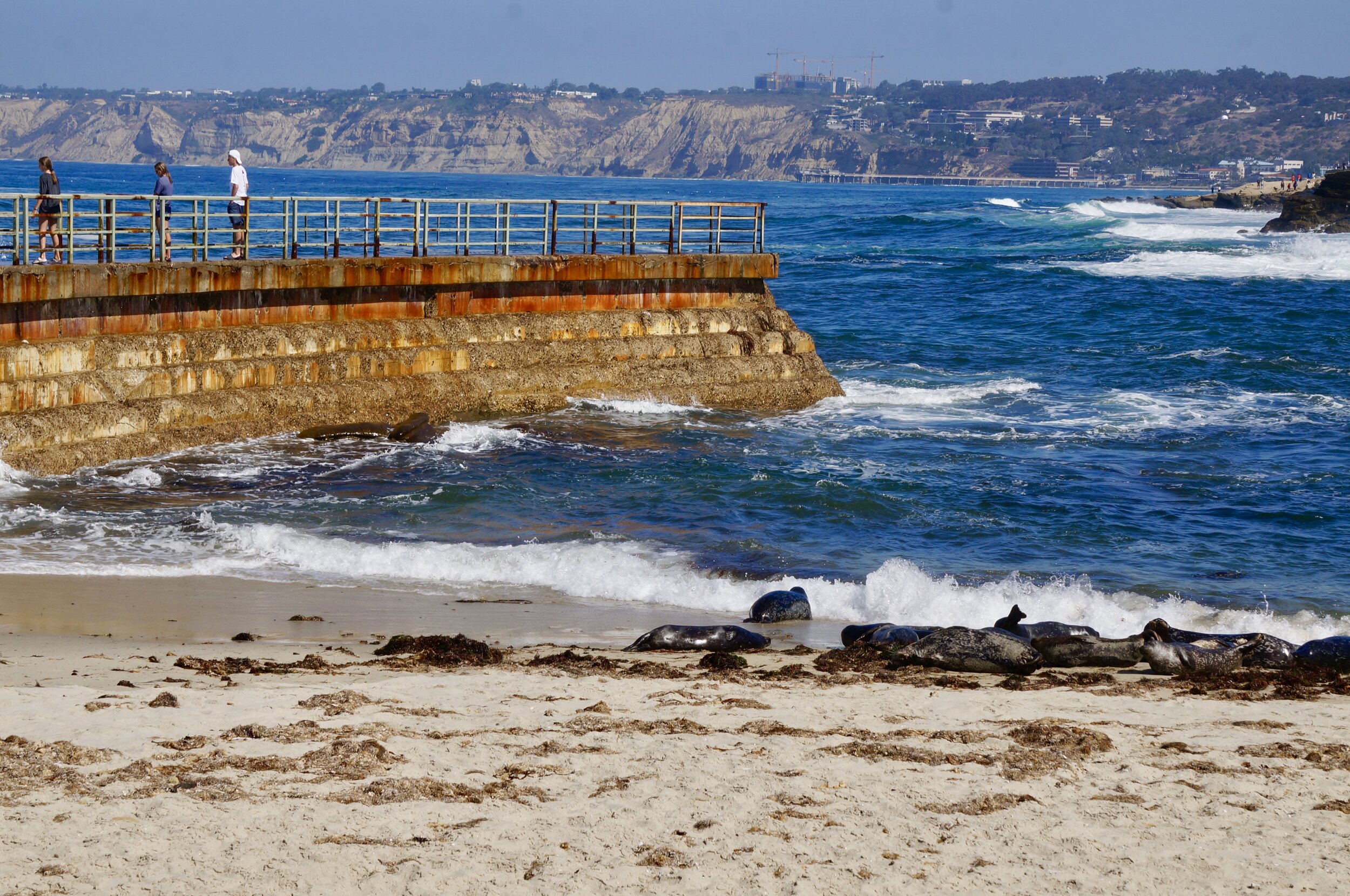
Harbor seals nap and play in the surf at Children’s Pool beach, a once beloved children’s beach that has been overrun by the seals.

Harbor seals nap and play in the surf at Children’s Pool beach, a once beloved children’s beach that has been overrun by the seals.

La Jolla, a tony seaside town near San Diego, California, is known for its miles of rugged coastline, nice shops and the world-class Torrey Pines Golf Course. Yet in recent years the town’s close proximity to the ocean has led to the arrival of some controversial visitors from the sea. If we were simply talking about some crabs scuttling around the tide pools at Shell Beach, this wouldn’t be a big issue. But when we start talking about dozens of 300-lb California sea lions taking over La Jolla beaches, then we potentially have a problem.

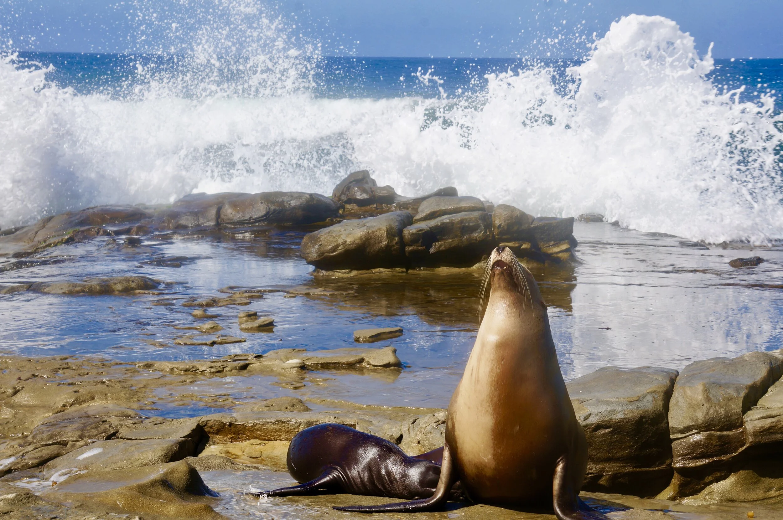
A mother California sea lion and her pup in front of the soaring sea foam near La Jolla Cove.

A mother California sea lion and her pup in front of the soaring sea foam near La Jolla Cove.

The existence of La Jolla’s pinnipeds (the town’s beaches are home to harbor seals as well as California sea lions) has been both a boon for tourists and a headache for some locals. These marine mammals are loud, smelly and leave puddles of excrement all over the picturesque coastline. To some, however, the most controversial issue with these adorably-lazy beach bums is the set of strict protections they carry around with them as protected marine mammals in the United States.

The Marine Mammal Protection Act was enacted 47 years ago today and protects all species of marine mammals swimming in our country’s waters. This includes the sea lions hanging around La Jolla as well as Florida’s manatees, California’s sea otters and all the species of whale that make vast migrations along both coasts each year. With very few exceptions (native Alaskans, for example, are still able to hunt marine mammals because of the practice’s cultural importance), no one is allowed to hunt or disturb marine mammals in their natural habitats, which includes the miles of dramatic coastline along La Jolla.

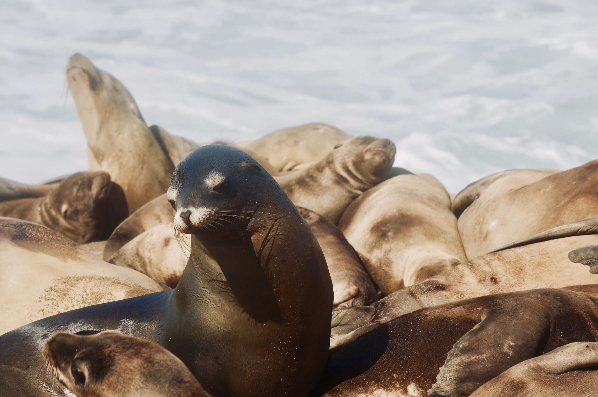
A California sea lion examines his place amongst the huddled masses of La Jolla Cove.

A California sea lion examines his place amongst the huddled masses of La Jolla Cove.

While many champion this act as a landmark conservation measure that protects some of our most beloved and charismatic creatures, local residents, who deal with these marine mammals daily, believe the act infringes on their rights to use the coastal land and beaches as they wish. A perfect example of this conflict is playing out on a stretch of sand called Children’s Pool.

This beach, sheltered from vicious ocean waves by a battered concrete seawall that has seen better days, was set aside in 1931 with the understanding that it would always be protected as a safe area for children to swim. But in the 1990s, a group of harbor seals swam into the sheltered spot and established a rookery where they could raise their pups in peace. The amount of seal excrement along the beach and in the water was enough to keep children out of the water. Moreover, the seals are both efficient carnivores and literal shark bait, both of which make them far from ideal swimming buddies! Over the last few decades, Children’s Pool has become a lightning-rod issue between those who tout the rights of local residents and those who believe the seals should take precedence.

Harbor seals: Southern California’s original beach bums.

Harbor seals: Southern California’s original beach bums.

Right now both sides have had to settle. The seals are still lounging around the beach, but the stricter protection that many conservation activists have clamored for has never been fully realized. The beach was recently closed during pupping season (between December 15 and May 15 each year) to prevent people from disturbing the animals and potentially causing a mother seal to flee her pup. But many wanted the beach closed year-round to prevent any human disturbance, which has become more prevalent as tourists vie for the best selfies.

A sign warns visitors not to get too close to seals at the entrance to Children’s Pool beach.

A sign warns visitors not to get too close to seals at the entrance to Children’s Pool beach.

Those who want to see Children’s Pool returned to local children are still fighting in courts to rid the beach of the seals. They received a victory in 2015 when an Orange County Superior Court ruled that it was a violation of state law to close the beach for the winter. The city appealed the ruling to continue the beach closure for pupping season, but no lasting conclusion has been reached yet.

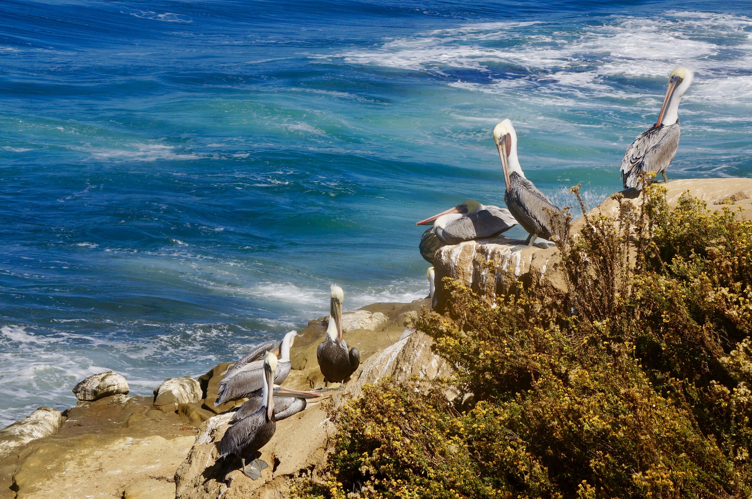
Albeit as someone who is not a La Jolla resident, I definitely come down on the side of protecting these marvelous marine mammals. I thought the presence of the California sea lions and harbor seals on the beaches was truly amazing and was one of my favorite parts of a recent weekend trip to San Diego. In addition to the pinnipeds, hundreds of pelicans were hanging out along the rocky cliffs. Regardless of how the battle over Children’s Pool ends, I strongly recommend bringing a zoom lens to capture pictures of the sea lions and pelicans so as not to endanger yourself or these magnificent wild animals in their natural habitat.

Brown pelicans relaxing on the rocky cliffs near Children’s Beach in La Jolla, California

Brown pelicans relaxing on the rocky cliffs near Children’s Beach in La Jolla, California

Read this for an idea of where to see these creatures if you ever make it to La Jolla.

All photographs by Jack Tamisiea. See more photographs of La Jolla’s seals and sea lions on the Natural Curios Instagram page.

Sources:

https://www.sandiegouniontribune.com/news/environment/sd-me-childrens-pool-20170516-story.html

https://ftw.usatoday.com/2018/04/tourists-are-loving-sea-lions-to-death-in-la-jolla

https://www.fws.gov/international/laws-treaties-agreements/us-conservation-laws/marine-mammal-protection-act.html